


-
 Redaction
Isostatic rebound: why sea level rise isn't equal
Sea level rise isn't uniform worldwide. Discover how ancient ice sheets still tilt the Earth's crust today, sinking some coastlines while lifting others.
To understand the contemporary coastline, one must look beyond the immediate rhythm of the tides and into the deep, sluggish movements of the Earth's interior. While global attention remains fixed on the melting of polar ice and the thermal expansion of seawater, a far older and more profound geological mechanism is quietly dictating which cities will drown and which will grow. This process is known as isostatic rebound, or glacial isostatic adjustment (GIA). It is a lingering echo from the last glacial period, a time when massive ice sheets, some several kilometers thick, exerted enough pressure to deform the Earth's very crust.
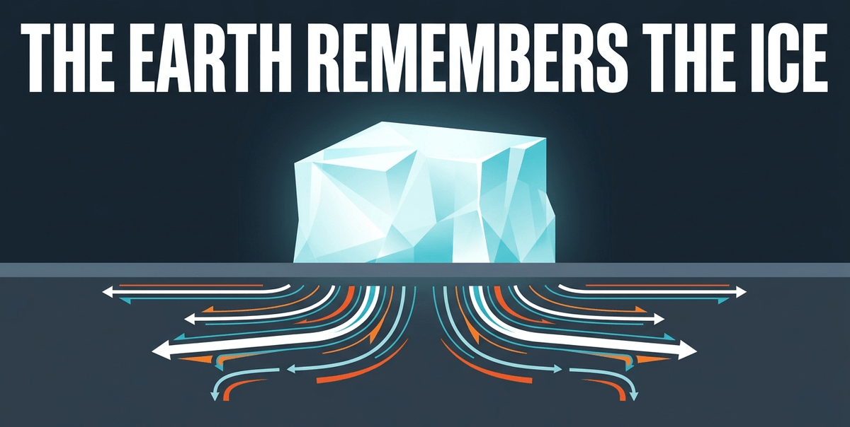
Today, thousands of years after those ice sheets retreated, the planet is still adjusting to their absence. This adjustment is not uniform, nor is it instantaneous. It is a slow, methodical "bounce back" that creates a complex patchwork of relative sea level changes. In some regions, the land is rising so fast that the sea appears to be retreating; in others, the land is sinking, effectively doubling the speed of sea level rise. To view sea level rise as a simple global average is to miss the fundamental geological reality that the Earth beneath our feet is rarely static.
I have spent enough field seasons on raised beach terraces to know that this is not an abstraction. Walk along the old shorelines of the Gulf of Bothnia and you are, quite literally, walking on the floor of a sea that existed within human memory. Walk along a marsh in the Chesapeake and you are standing on ground that is quietly withdrawing beneath you. Both places are responding to the same ice age. They are simply on opposite sides of the same seesaw.
The mechanics of glacial isostasy and the asthenosphere
The fundamental principle behind this phenomenon is glacial isostasy, which describes how the Earth's lithosphere - the rigid outer shell - interacts with the underlying asthenosphere. The asthenosphere is a semi-fluid, viscous layer of the mantle that behaves like a highly pressurized liquid over geological timescales. When an ice sheet of immense weight forms on a continental plate, it pushes the lithosphere down into the asthenosphere. Like a person sitting on a waterbed, the weight displaces the fluid beneath it, causing the asthenosphere to flow away from the center of the load.
This displacement creates two distinct geological features: a depression directly under the ice and a peripheral bulge at the edges of the ice sheet. When the climate warms and the ice melts, the process reverses. The weight is removed, and the asthenosphere begins to flow back into the space beneath the depressed crust. The land starts to rise, or "rebound," in the center, while the peripheral bulges begin to collapse and sink.

Because the asthenosphere is incredibly viscous, this flow happens at a geological crawl. Equilibrium is not reached in centuries, but in millennia. We are currently living through the middle of this recovery phase. According to geophysical data, rebound of this kind will continue for thousands of years more before the Earth returns to something resembling its pre-glacial state. This movement is the primary reason why global mean sea level rise - now tracking at roughly 3.4 to 3.8 mm per year according to satellite altimetry records, and accelerating - does not translate to the same experience for every coastal community.
"We're like a teeter-totter," geographer Michael Scott of Salisbury University once observed of the Chesapeake region - a phrase that, in my experience, describes the whole of post-glacial geography rather neatly.
Two additional mechanisms worth understanding
Glacial isostasy rarely acts alone, and two related processes deserve mention because they explain why the effects of an ice sheet's disappearance are felt so far beyond its old boundaries.
- Ocean siphoning. As peripheral bulges collapse far from the former ice margin, they quietly increase the total volume of the ocean basin. Water drains toward these newly created depressions, gently lowering sea level in regions nowhere near the original ice sheet.
- Continental levering. As continental shelves near the former ice margin tilt and adjust, water is redistributed toward or away from adjacent coastlines, independent of any change in the total volume of the ocean.
Both mechanisms mean that isostatic effects are never strictly local. A retreating ice sheet in Canada leaves its signature on shorelines a hemisphere away.

The North American seesaw: uplift versus subsidence
North America provides a striking example of how isostatic rebound creates winners and losers in the battle against rising seas. During the last glacial maximum, the Laurentide Ice Sheet covered almost all of Canada and reached down into the Northern United States. The weight was so great that it depressed the Canadian Shield while forcing the crust along the U.S. Mid-Atlantic coast to bulge upward.
Currently, the continent is experiencing what geologists often call a "seesaw effect." In the north, around Hudson Bay, the land is rebounding at a rapid pace. GPS networks and satellite altimetry data show present-day uplift rates of up to 10 to 11 mm per year at the center of the old ice load - among the fastest rates of vertical land motion recorded anywhere on the planet. In these regions, the land is rising faster than the ocean is filling with meltwater, meaning the relative sea level is actually falling.
However, further south, the story is far more precarious. Regions that once formed the peripheral bulge - such as the Chesapeake Bay, the Mid-Atlantic coast, and parts of the South - are now subsiding. As the bulge collapses, the land sinks. NASA's Sea Level Change Portal puts the Chesapeake's isostatic subsidence at around 2 mm per year, though a 2026 study using satellite radar - the most detailed vertical land motion survey of the bay to date - clocked the regional average nearer to 1.4 mm per year, with pockets around Hampton Roads and the lower Eastern Shore sinking considerably faster. Groundwater withdrawal compounds the geological signal in several of these hotspots, pushing localized subsidence rates as high as 4 to 7 mm per year in places like Franklin and Suffolk, Virginia.
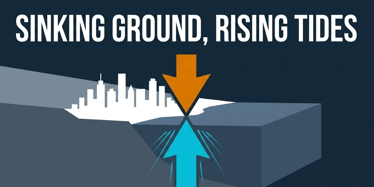
When you combine this sinking land with the global average sea level rise, the result is an accelerated threat. In coastal communities near Cape Hatteras, North Carolina, and Virginia, sea levels rose by nearly a foot and a half during the 20th century. This is significantly higher than the rise seen in places like Portland, Maine, which sits further north and benefits from modest crustal uplift.
Data from recent environmental assessments suggests that in the western Gulf of America, sea level rise is projected to reach 16 to 18 inches above 2020 levels by 2050 - a figure that, in some localities such as Galveston, Texas, could climb even higher, to nearly two feet. This is nearly half a foot higher than the national average, a direct consequence of the geological reality that the ground is moving down while the water moves up. Along the western Gulf, isostatic effects are joined by an aggressive human signature: decades of oil, gas, and groundwater extraction have caused the land itself to compact, a process researchers increasingly treat as inseparable from the natural subsidence left over from the last ice age.
By contrast, the Pacific Northwest tells yet another story. In parts of Alaska and the Pacific coast, tectonic uplift and rapid glacial isostatic rebound from more recent, smaller ice masses are actively lifting the land, in some cases fast enough to mask the true scale of glacier melt when measured from orbit. A study published in Communications Earth & Environment in 2026 found that rapid isostatic rebound in Alaska and Iceland has been concealing roughly 4 percent of global glacier mass loss from satellite gravity measurements - a reminder that the rebound signal is not just a curiosity of coastal planning, but an active source of noise in how we measure the health of the cryosphere itself.

The Baltic Sea: where the land wins the race
Perhaps nowhere is the power of isostatic rebound more visible than in Northern Eurasia, specifically the Fennoscandian region. Approximately 20,000 years ago, a massive ice sheet up to 3,000 meters thick blanketed the Baltic Sea, depressing the crust by more than 500 meters. Today, this region exhibits some of the highest rates of glacial isostatic adjustment on the planet.
In the Gulf of Bothnia, the land is rising at a peak rate of about 11 mm per year. In the Kvarken Archipelago of Finland, the geological transformation is so rapid that it is visible within a single human lifetime. The uplift rate here has held at roughly 8 to 9 mm per year for the past century, and every year, approximately 700 hectares of new land - an area about twice the size of New York's Central Park - emerge from the sea along this stretch of coast. Since the ice retreated, the total uplift here has reached at least 286 meters, the highest post-glacial rebound recorded anywhere in the world.
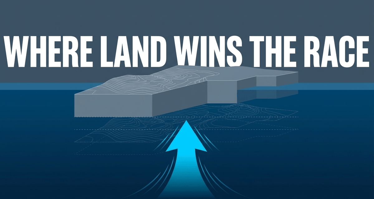
Boathouses built at the water's edge a century ago now sit hundreds of meters inland, surrounded by meadows. I find something quietly humbling about this: entire fishing towns, like Vaasa in Finland, have had to relocate their harbors as the sea has, in effect, walked away from them.
In this specific geography, the rate of regional uplift vastly outpaces the current global sea level rise. While most of the world worries about disappearing coastlines, the northern Baltic is expanding. However, projections illustrate a stark divide: while the northern part of the Baltic Sea may see a relative sea level fall of up to 0.6 meters by the century's end, the southern Baltic - which lacks this uplift - could see a rise of up to 0.7 meters over the same period. This highlights the necessity of localized climate planning; a policy that works for Helsinki may be disastrous for Gdansk. It is a divide worth keeping in mind alongside other slow-motion planetary readjustments, such as how monsoon rains and mountain uplift in Tibet have reshaped Earth's long-term carbon cycle - both are reminders that the crust and climate are in constant, patient conversation with one another.
Beyond ice: other drivers of regional sea level variance
While isostatic rebound is a primary driver of uneven sea level rise, it does not act in a vacuum. Several other factors contribute to the "lumpy" nature of the world's oceans. Understanding these variables is critical for accurate coastal modeling and infrastructure planning.
Thermal expansion and ocean heat distribution
Warmer water occupies more volume than colder water, a process known as thermal expansion. However, the ocean does not warm uniformly. Currents like the Gulf Stream redistribute heat, leading to localized "bulges" of warmer water that sit higher than cooler regions. For much of the 20th century, thermal expansion was the dominant driver of global sea level rise. In recent decades that balance has shifted: meltwater from mountain glaciers and the Greenland and Antarctic ice sheets now contributes a share roughly equal to, and in many recent years exceeding, thermal expansion's contribution.
Gravitational fingerprints of melting ice
A fascinating and often counter-intuitive factor is the change in gravitational pull. Large ice sheets, such as those on Greenland and Antarctica, possess immense mass and exert a gravitational pull on the surrounding ocean, literally drawing water toward them. As these ice sheets melt and lose mass, their gravitational pull weakens.
This results in a phenomenon known as sea-level fingerprints. When the Greenland ice sheet melts, the water level actually drops in the vicinity of Greenland because the "tug" on the ocean is gone. That water then redistributes across the globe, leading to a higher-than-average sea level rise in the Southern Hemisphere and around the tropics, thousands of kilometers from the melting source. Each melting ice source - Greenland, West Antarctica, individual mountain glacier systems - has a unique fingerprint that determines where the water will eventually settle. It is one of the more elegant, if unsettling, demonstrations that the ocean is not a bathtub filling evenly from a tap, but a surface shaped by gravity itself.
Localized subsidence and human intervention
Not all vertical land motion is natural. In many of the world's most vulnerable deltas, human activity is causing the land to sink far faster than any geological process could on its own. Groundwater extraction, oil and gas mining, and the drainage of organic soils cause the ground to compact and subside. In cities like Jakarta or New Orleans, this localized subsidence can reach tens of millimeters per year - in Jakarta's case, in some districts, considerably more - dwarfing the rates of both isostatic rebound and global sea level rise. Along the U.S. Atlantic coast alone, recent satellite-based mapping has found that subsidence exceeding 3 mm per year now affects most coastal marshes, wetlands, and cultivated land, a finding that suggests earlier vulnerability assessments substantially underestimated the risk to these ecosystems.

This is the uncomfortable truth of coastal science: geology loads the gun, but human water and resource extraction often pulls the trigger.

Share now









Key takeaways
- Isostatic rebound, or glacial isostatic adjustment (GIA), is the ongoing rise of land masses once depressed by the weight of Ice Age glaciers.
- The semi-fluid asthenosphere slowly flows back beneath areas where ice has melted, pushing the crust upward over thousands of years.
- Global mean sea level is currently rising at roughly 3.4 to 3.8 mm per year, and this rate is accelerating according to satellite altimetry records.
- Isostatic rebound causes extreme regional variance: some coastlines rise faster than the ocean is filling, while others sink, magnifying local sea level rise.
- In the Kvarken Archipelago, Finland, land rises at roughly 8 to 9 mm per year, with about 700 hectares of new land emerging annually.
- Around Hudson Bay, Canada, present-day uplift reaches up to 10 to 11 mm per year, among the fastest vertical land motion on Earth.
- Peripheral "bulge" regions like the U.S. Mid-Atlantic coast and Chesapeake Bay are now subsiding at roughly 1.4 to 2 mm per year from geological causes alone, worsening local flooding risk.
- Human activity - especially groundwater withdrawal - can push localized subsidence rates in places like Virginia's Hampton Roads region to 4 to 7 mm per year.
- The western Gulf of America (Gulf of Mexico) is projected to see sea levels rise 16 to 18 inches above 2020 levels by 2050, nearly half a foot above the U.S. national average.
- Sea-level fingerprints mean that melting ice sheets lower sea level near the ice itself, while raising it disproportionately in the opposite hemisphere, due to shifting gravitational pull.
- Rapid isostatic rebound in Alaska and Iceland has been found to mask roughly 4 percent of global glacier mass loss in satellite gravity measurements.
- The IPCC AR6 report states with high confidence that global sea level is rising faster than at any point in at least 3,000 years.
Sources
- Wikipedia https://en.wikipedia.org/wiki/Post-glacial_rebound
- NASA Sea Level Change Portal https://sealevel.nasa.gov/understanding-sea-level/regional-sea-level/subsidence/
- NOAA Climate.gov https://www.climate.gov/news-features/understanding-climate/climate-change-global-sea-level
- USGS https://www.usgs.gov/publications/land-subsidence-and-relative-sea-level-rise-southern-chesapeake-bay-region
- NASA Earth Observatory https://science.nasa.gov/earth/earth-observatory/uplift-underway-in-finlands-kvarken-archipelago-153740/
- Published 2026-07-31 18:16
- Modified 2026-07-31 18:21

-
Redaction