

-
 PRO
PRO -
 Redaction
How new technology is dating earth's history
Advanced stratigraphy methods now use direct dating and AI to map Earth's history, from Iron Age Jerusalem seeds to ancient sandstorms on Mars.
Stratigraphy - the science of reading Earth's layered rock record - is undergoing one of its most significant methodological transformations in decades. Driven by advances in isotopic analysis, accelerator mass spectrometry, and artificial intelligence, researchers can now date sedimentary sequences, ancient artworks, and archaeological sites with a precision that was unthinkable just a generation ago. The implications span deep geological time, human prehistory, and even the surface of Mars.
Direct chronometric precision
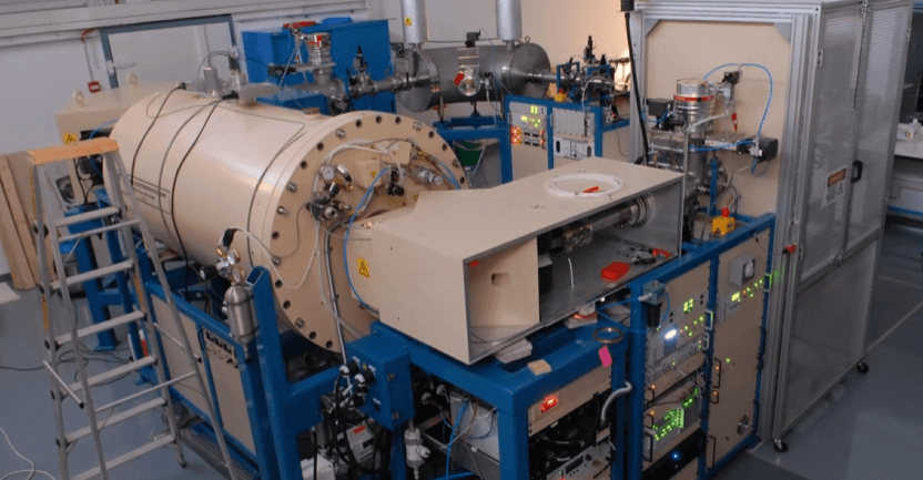
Geological time has long been measured through indirect markers. Traditionally, scientists relied on volcanic ash layers or specific fossil assemblages to bracket the age of sedimentary rocks. However, the field of stratigraphy is undergoing a significant transition toward direct dating of the sedimentary matrix itself. Recent technological refinements now allow for the direct dating of carbonate minerals - specifically calcite and dolomite - using U-Pb (uranium-lead) geochronology. This capability represents a genuine shift in how geologists assign ages to the layers recording Earth's historical processes.

The primary challenge in this pursuit involves the low uranium concentrations found in many carbonates. These minerals are also highly sensitive to chemical alteration after deposition, which can introduce scatter into isotopic measurements. According to current research, uncertainties in dating these sedimentary rocks can reach 10% of the measured age. In deep-time geological scales, this margin can translate to tens of millions of years - a significant range when trying to resolve evolutionary events or stratigraphic boundaries.
Despite these hurdles, the move toward direct analysis fundamentally reduces the reliance on external geological events to calibrate the stratigraphic column. The ability to date the rock itself, rather than something found within it, is a paradigm shift that gives geologists far greater independence and chronological resolution.
Absolute chronology in archaeological strata
The application of stratigraphic principles to human history has reached a new level of precision through advanced radiocarbon techniques. In Jerusalem, a research team from the Weizmann Institute of Science, Tel Aviv University, and the Israel Antiquities Authority has established an absolute chronology for the Iron Age by focusing on organic material found within distinct layers. By analyzing 103 archaeological samples - consisting of single charred items, mostly seeds - using D-REAMS laboratory techniques, researchers have bypassed previous chronological hurdles.
One such obstacle is the Hallstatt plateau, a period between 800 and 400 BCE where radiocarbon levels in the atmosphere remained relatively static, making precise dating exceptionally difficult. By cross-referencing the sample data with 100 calendar-dated tree rings sourced from Irish oak and Bristlecone pine archives, the team successfully tightened the timeline for urban development in the region.
Critically, the team also employed Bayesian statistical modelling to integrate the radiocarbon measurements with stratigraphic context - treating each sample's physical position within the dig as prior information that constrains the date range. This combined approach treats the archaeological site as a living stratigraphic sequence, where every organic remnant is a data point in a larger temporal map. The result, published in PNAS (2024), is a chronological framework precise enough to correlate specific construction phases with historically documented events.
Imaging the past through mineral crusts and magnetism
Laser-ablation in cave art analysis
The dating of ancient cave art has often been speculative, largely due to the absence of organic pigments suitable for traditional radiocarbon dating. Modern stratigraphy now employs laser-ablation Uranium-Thorium (U-Th) dating to analyze the thin carbonate crusts that form over artwork over millennia. As uranium trapped in these crusts decays into thorium, it creates a precise chemical clock. This technique provides a minimum age for the underlying art - the crust must post-date the painting beneath it.
To maintain accuracy, laboratories utilize strict calibration sequences with international reference standards, performing regular checks throughout analytical sessions to account for instrument drift. The method has already pushed back the confirmed date of figurative art at several European sites, reinforcing the considerable antiquity of symbolic human behavior.
Archaeomagnetic signatures of Paleolithic hearths
At sites like El Salt in Spain, researchers are combining archaeomagnetic analysis with archaeostratigraphy to distinguish between separate occupation events separated by decades or centuries. By measuring the magnetic orientation recorded in the burned minerals of ancient fire pits, scientists can determine the relative time elapsed between successive uses of a hearth - an approach that bypasses the limitations of radiocarbon dating in younger or chemically contaminated contexts.
Data from a landmark study published in Nature (2024) indicates that six specific Neanderthal hearths at El Salt were utilized over a span of 200 to 240 years, with intervals between fires spanning decades or even up to a century. These findings suggest that Neanderthal groups returned to the same locations across multiple generations, demonstrating a long-term spatial memory of the landscape that challenges earlier assumptions about the cognitive and social capabilities of archaic humans.

Reconstructing ancient landscapes and extraterrestrial records
Detrital zircon and paleodrainage
Understanding how rivers migrated across continents millions of years ago requires more than mapping old channels. Geologists now use detrital zircon analysis - comparing the uranium-lead isotopic age of mineral grains in ancient dry beds to known source rocks - to trace the provenance of sediment across vast distances and timescales. When the isotopic signature of a grain matches a distant mountain range, it reveals the former path of a river that no longer exists.
This approach has been instrumental in tracking the Miocene Epoch's Colorado River. Recent findings published in Science (2026) have linked the river's historical path to a now-dry lakebed - the Bidahochi basin - located east of the Grand Canyon. This multi-process integration model supports the lake-spillover hypothesis for the canyon's formation and moves the discipline away from single-mechanism theories toward a more complex, holistic view of erosion and tectonic interaction.
The Martian stratigraphic record
Stratigraphy is no longer a science confined to Earth. On Mars, the identification of fossilized ripple structures roughly 3.6 billion years old in the stratigraphic record of Gale crater marks a significant milestone in planetary science. Discovered serendipitously by NASA's Curiosity rover and published in Geology, these so-called supercritical climbing wind ripples represent the first direct physical evidence of an ancient sandstorm on Mars. Their presence indicates that the planet once possessed a much denser atmosphere capable of sustaining high-energy weather patterns - a key constraint for models of Martian habitability and climate evolution.
The application of terrestrial stratigraphic principles to Martian geology allows for a meaningful comparative analysis of planetary evolution, demonstrating that the conceptual tools developed to read Earth's rock record translate powerfully to other worlds.
How Bayesian modelling is sharpening chronological precision
Across multiple sub-disciplines, Bayesian chronological modelling is emerging as a unifying methodology. Rather than treating each radiometric date as an isolated measurement, Bayesian approaches integrate multiple lines of evidence - stratigraphic superposition, sample type, laboratory precision, and historical context - into a single probabilistic framework. The output is not just a date range but a calibrated probability distribution that explicitly encodes uncertainty.
This is particularly powerful when working through problematic periods like the Hallstatt plateau, or when correlating sequences across geographically distant sites. As datasets grow larger and more complex, Bayesian modelling provides a mathematically rigorous method for synthesising information that no single dating technique could resolve alone.
The integration of artificial intelligence and future outlooks
As the volume of stratigraphic data grows, the role of Artificial Intelligence in geological workflows has expanded considerably. The U.S. Geological Survey (USGS) is currently implementing a comprehensive AI strategy - detailed in USGS Circular 1562 - intended to improve interpretation accuracy and decision-making across geoscience disciplines. AI models are particularly effective at evaluating multiple geological scenarios simultaneously, a task that would take human researchers significantly longer to perform.
However, the scientific community remains appropriately cautious. AI lacks the physical judgment required for fieldwork and can struggle with the nuance of research topics where data is sparse or poorly structured. There is an increasing focus on the archaeology of neural nets - an effort to understand the internal logic AI models use to arrive at predictions - to ensure that results remain scientifically sound and ethically transparent.
Looking ahead to the STRATI 2026 congress in Suzhou, China, the focus will remain on the "Middle Age" of Earth - the period between 1.8 and 0.8 billion years ago - where boundary delimitations remain contested and new dating techniques are urgently needed. As those boundaries are refined and methodologies standardized globally, the clarity of Earth's historical timeline continues to improve.
Whether through the study of charred seeds in Jerusalem, magnetic minerals in a Neanderthal fire pit, or ancient sandstorms preserved in Martian rock, the layers of the past are becoming increasingly legible - one isotope at a time.
Share now


Key takeaways
- Direct carbonate dating: Researchers now apply U-Pb (uranium-lead) geochronology directly to carbonate minerals - calcite and dolomite - eliminating the need for external volcanic marker horizons to calibrate sedimentary sequences.
- Iron Age Jerusalem chronology: A multi-institution team analyzed 103 single charred samples (mostly seeds) using D-REAMS accelerator mass spectrometry and Bayesian modelling to establish a precise radiocarbon chronology for Iron Age Jerusalem, overcoming the problematic Hallstatt plateau (800-400 BCE).
- Cave art minimum ages: Laser-ablation U-Th (uranium-thorium) dating of thin carbonate crusts overlying prehistoric imagery provides minimum ages for cave art - even where no organic pigments are present for conventional radiocarbon analysis.
- Neanderthal landscape memory: Interdisciplinary archaeomagnetic analysis of six Neanderthal hearths at El Salt, Spain, reveals that the same site was reused over a span of 200 to 240 years, with decade- to century-long intervals between occupation events - indicating multi-generational spatial memory of the landscape.
- Colorado River origin traced: Detrital zircon U-Pb isotopic dating has linked the Miocene-era Colorado River to the Bidahochi basin, a now-dry lakebed east of the Grand Canyon, providing strong evidence for the lake-spillover hypothesis of canyon formation.
- First direct evidence of a Martian sandstorm: Supercritical climbing wind ripples roughly 3.6 billion years old, identified in Gale crater by NASA's Curiosity rover, constitute the first physical stratigraphic evidence of an ancient sandstorm on Mars - implying a formerly much denser Martian atmosphere.
- AI in geological workflows: The USGS and other bodies are integrating AI to accelerate stratigraphic interpretation and multi-scenario modelling, while the research community actively works to ensure methodological transparency and ethical accountability in AI-assisted geoscience.
- Bayesian modelling as a unifying method: Across radiocarbon studies, archaeomagnetics, and isotopic dating, Bayesian statistical frameworks are increasingly used to integrate multiple dating methods and stratigraphic context into a single calibrated chronological model.
- STRATI 2026 focus: The upcoming international stratigraphy congress in Suzhou, China, will focus on Earth's poorly understood "Middle Age" (1.8-0.8 billion years ago), where new dating standards and boundary definitions are urgently needed.
Sources
- Radiocarbon chronology of Iron Age Jerusalem https://www.pnas.org/doi/10.1073/pnas.2321024121
- The time between Palaeolithic hearths (Nature, 2024) https://www.nature.com/articles/s41586-024-07467-0
- Curiosity stumbles upon evidence of ancient Martian winds (Eos, 2026) https://eos.org/research-and-developments/curiosity-stumbles-upon-evidence-of-ancient-martian-winds
- Late Miocene Colorado River arrival in the Bidahochi basin (Science, 2026) https://www.science.org/doi/10.1126/science.adz6826
- Scientists refine dating of ancient cave art using advanced uranium-series techniques (HeritageDaily, 2026) https://www.heritagedaily.com/2026/03/scientists-refine-dating-of-ancient-cave-art-using-advanced-uranium-series-techniques/157246
- USGS AI Strategy - USGS Circular 1562 https://pubs.usgs.gov/publication/cir1562/full
- Published 2026-04-28 21:34
- Modified 2026-06-11 18:00

-
Redaction