

-
 Redaction
Strategic chokepoints: geography's hidden power
Chokepoints like Hormuz, Malacca and Suwalki shape global power. Explore why narrow terrain still decides trade, energy and military outcomes worldwide.
Geography is the ultimate arbiter of human ambition. Technology advances, digital connectivity expands, and capital moves at the speed of light - yet the physical reality of the planet remains the foundation on which global power is built. At the heart of that reality lie chokepoints: narrow stretches of land or water that force transit through a severely constricted front. These are not geographic curiosities. They are the hinges of history, the anchors of commerce, and the primary fixation of military planners everywhere.
A chokepoint is defined by three conditions converging at once: narrowness, indispensability, and the absence of any practical alternative. When those three factors line up, a single point on a map gains the power to dictate economic and security outcomes for entire continents. Strip away the jargon and the logic is almost embarrassingly simple - control the narrow part, and you control what flows through it.
The anatomy of strategic constriction
To understand why a few kilometers of water or a single mountain pass can hold the world hostage, it helps to break the concept down into layers. A chokepoint operates across four distinct planes, and each one reinforces the others.
The most obvious is the physical plane, where terrain compresses movement and denies maneuver. In open water or a vast plain, an army or a fleet can spread out, exploiting numbers and speed. In a chokepoint, that same force is funneled into a single predictable, crowded lane. This physical compression leads directly into the economic plane. Because these routes are often the shortest - or only - viable paths for trade, they concentrate energy, minerals, and entire supply chains into one high-risk corridor.
Beyond the tangible sits the informational plane. These passages are no longer just for ships; they double as corridors for the undersea cables carrying the overwhelming majority of the world's internet traffic. And finally, there is the psychological plane, which is often underestimated. The mere perception of risk at a chokepoint can reroute global shipping, spike insurance premiums, and rattle stock markets long before a single shot is fired or a vessel is actually blocked. This psychological pressure frequently moves markets faster than the physical reality on the ground - a dynamic that has played out repeatedly across the Middle East and Eastern Europe in recent years.
The strategic logic of the force multiplier
In military terms, a chokepoint functions as the ultimate equalizer. It strips an attacker of the ability to bring superior numbers to bear. In a narrow valley or a thin strait, a numerically inferior defending force can hold off a much larger adversary, simply because only a fraction of the attacking force can engage at any given moment. This concept of the force multiplier has held constant from the ancient battles of Thermopylae to modern naval standoff scenarios. Historical military analysis consistently points to the same structural truth: the side that controls the high ground, or the narrowest point of the passage, holds an advantage that technology can erode but never fully erase.
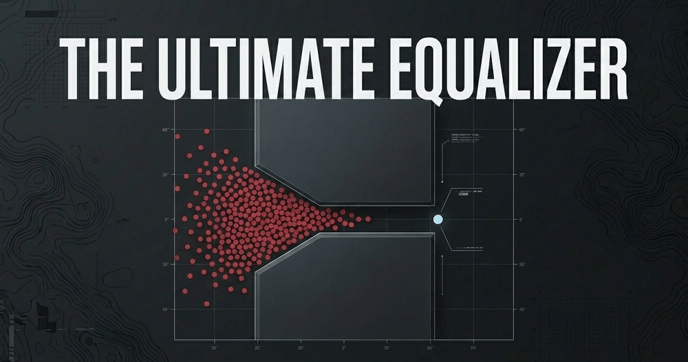
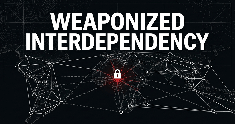
Control over these narrow spaces also confers disproportionate influence on states, corporations, or non-state actors - a dynamic often described as "chokepoint politics." In this environment, a state does not need a global blue-water navy to project international leverage. It only needs the ability to deny, delay, or monitor traffic through one vital passage. This creates a condition of weaponized interdependency, in which the very systems that bind the world together become the levers used to pull it apart. Control over a chokepoint allows an actor to extract transit fees, monitor sensitive shipments, or threaten the energy security of rivals - often without firing a shot.
Maritime giants: the arteries of global energy and trade
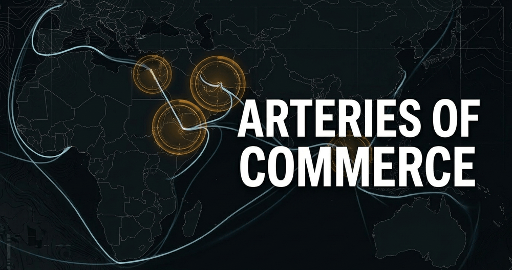
Maritime chokepoints remain the most consequential features of the modern global economy. Sea travel is still the primary means of moving bulk goods, energy, and military hardware, which makes the straits and canals that constrain it the genuine lifeblood of international commerce.
The Strait of Hormuz: the world's energy valve
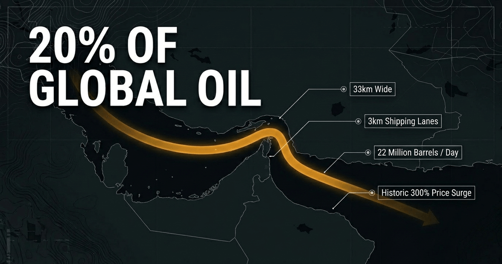
Connecting the Persian Gulf to the Indian Ocean, the Strait of Hormuz is arguably the single most sensitive maritime passage on Earth. At its narrowest point it is only about 33 kilometers wide, with the actual shipping lanes - separated by a buffer zone - measuring roughly two miles across in each direction. In a normal year, somewhere between one-fifth and one-quarter of the world's total oil consumption and around 20% of global LNG trade move through this corridor, primarily destined for Asian markets including China, India, Japan, and South Korea.
What makes Hormuz different from almost every other chokepoint on this list is that it has, in 2026, stopped being a theoretical risk. The strait was effectively closed for an extended period following Iran's response to strikes by the United States and Israel, marking what energy analysts have described as the largest single disruption to the global oil market in modern history - exceeding even the shock of the 1973 OPEC embargo. Tanker insurance rates tripled within days, shipping volumes through the strait collapsed by more than 90%, and oil production across the Gulf states fell by millions of barrels per day as tankers simply could not transit. Brent crude jumped from roughly $75 to above $100 a barrel in a matter of days.
"The closure represents the largest supply disruption in the history of the global oil market," analysts noted at the time - a sentence that, a year earlier, would have read as alarmist hyperbole.
The episode is a near-perfect illustration of every theoretical point made above. The physical disruption was real - mines, attacks on tankers, and a formal naval blockade. The economic shock was immediate and global, hitting fertiliser supplies and petrochemical feedstocks as far away as consumer plastics manufacturing. The informational dimension surfaced too, with reports of discussions around fees and control over the undersea cables that also run through the strait. And the psychological plane dominated headlines for weeks, with markets pricing in worst-case scenarios well before the practical effects were fully felt. As of mid-2026, traffic through the strait remains a fraction of pre-crisis levels even as diplomatic efforts continue, and the structural vulnerability that analysts warned about for decades has, for the first time in fifty years, been tested in full.
The Suez Canal and the Bab-el-Mandeb
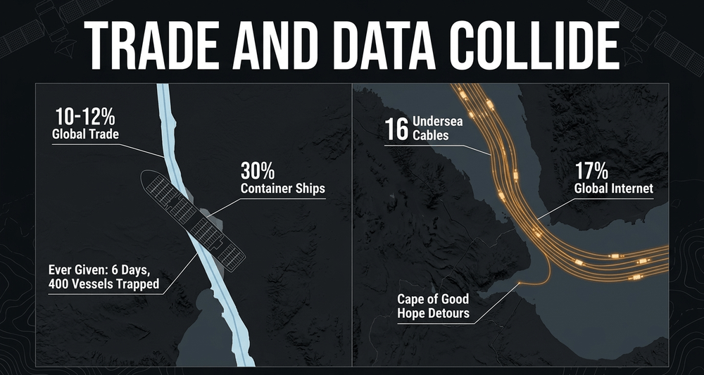
Egypt's Suez Canal is a roughly 193-kilometer artificial waterway that handles somewhere between 10% and 12% of global trade by value, and around 30% of all container shipping moving between Asia and Europe. It remains the primary shortcut linking the two continents, saving ships the multi-week detour around the southern tip of Africa.
The canal's vulnerability was demonstrated with unusual clarity in 2021, when the container ship Ever Given became wedged diagonally across its width. The blockage lasted roughly six days before the vessel was freed, but it trapped hundreds of ships and disrupted global supply chains for months afterward - a single 400-meter object freezing a meaningful share of world trade. The canal is also an informational chokepoint of the first order: more than a dozen undersea cables pass through the Suez corridor and the adjoining Red Sea route, carrying a substantial share of internet traffic between Europe, Africa, and Asia, in what analysts have called one of the most cable-dense - and most vulnerable - stretches of infrastructure on the planet.
To the south of the Suez lies the Bab-el-Mandeb Strait, sometimes translated as the "Gate of Tears." Connecting the Red Sea to the Arabian Sea, it narrows to under 30 kilometers at its tightest point. In recent years its strategic weight has been thrown into sharp relief by repeated attacks on merchant shipping in the surrounding waters, which forced many shipping companies to reroute entirely around the Cape of Good Hope - adding thousands of nautical miles and substantial cost to global trade. It is one of the clearer modern proofs that a non-state actor, armed with relatively cheap drones and missiles, can disrupt the entire global maritime order simply by raising the perceived risk of transiting one narrow strait. The dynamics of this kind of disruption-below-the-threshold-of-war are explored in more depth in how the Thucydides trap shapes geopolitics, which examines how rising and established powers manage friction without tipping into open conflict.
The Strait of Malacca: Asia's energy bottleneck
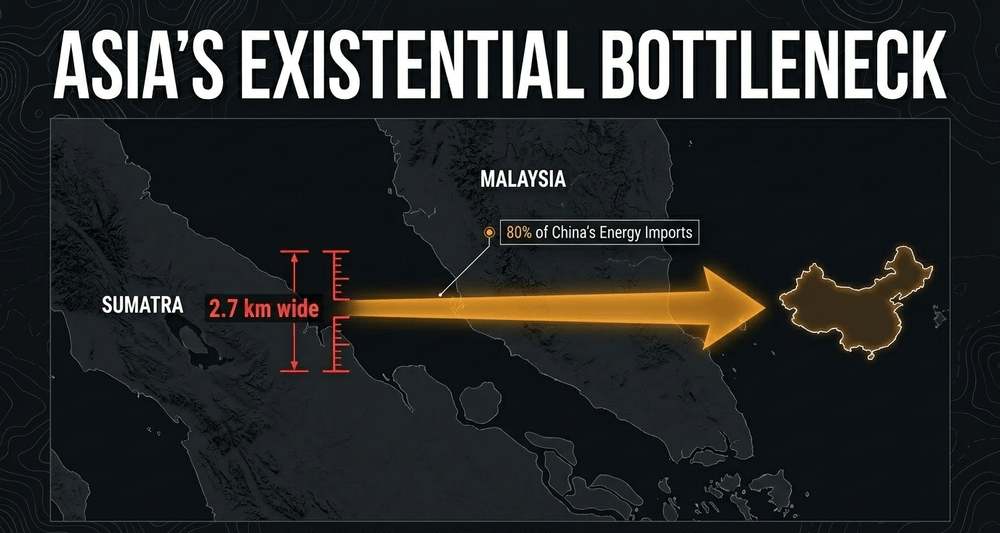
Located between Malaysia and the Indonesian island of Sumatra, the Strait of Malacca is the primary maritime link between the Indian and Pacific Oceans. Roughly a quarter to nearly a third of the world's seaborne oil trade passes through it, alongside an enormous share of containerized cargo - some estimates place its total share of global trade at close to a third when all cargo types are combined.
For China, Malacca is not an abstract concern; it is the defining vulnerability of its entire energy posture. The vast majority of China's seaborne crude oil imports - commonly cited at somewhere between 75% and 80% - pass through this single corridor, a dependency so consequential that Chinese strategists have a name for it: the "Malacca Dilemma." At its narrowest point, the Phillips Channel, the strait constricts to roughly 2.7 kilometers wide, an extraordinarily tight gate for one of the busiest shipping lanes on the planet. This extreme constriction also makes it a longstanding hotspot for piracy and a primary strategic vulnerability in the event of any regional conflict involving China's maritime supply lines. Proposals to bypass the strait entirely - most notably a canal across Thailand's Kra Isthmus - have circulated for decades, but as of 2026 remain a recurring topic of discussion rather than a built reality.
Land-based bottlenecks: the flashpoints of terrestrial conflict
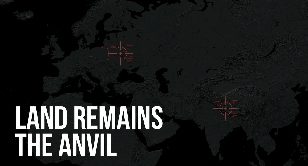
While maritime routes dominate economic discussion, land-based chokepoints define regional security architecture and the practical viability of military alliances. These are the places where the movement of heavy armor and logistics is restricted by mountains, borders, or hostile neighboring territory.
The Suwalki Gap and the Siliguri Corridor
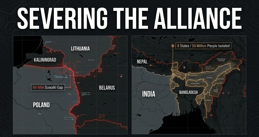
The Suwalki Gap is a strip of land - estimates generally place its width somewhere between 40 and 65 miles depending on how the boundary is drawn - running along the Polish-Lithuanian border. It is flanked on one side by the Russian exclave of Kaliningrad and on the other by Belarus, a state closely integrated into Russian military planning. Analysts have repeatedly described it as among the most consequential pieces of terrain in any hypothetical NATO-Russia confrontation. If this corridor were ever severed, the Baltic states would be physically cut off from the rest of the alliance by land, forcing any reinforcement to come by sea or air under contested conditions. This single geographic fact shapes a disproportionate share of NATO planning in the region, prioritizing speed and pre-positioned readiness in a way few other stretches of the alliance's territory require.
A structurally similar - though demographically far larger - problem exists on the other side of Eurasia. India's Siliguri Corridor, often nicknamed the "Chicken's Neck," is a strip of land connecting India's northeastern states to the rest of the country. Depending on the source, its narrowest point measures somewhere between roughly 12 and 17 miles across, flanked by Nepal, Bhutan, Bangladesh, and a wedge of Chinese-controlled territory known as the Chumbi Valley. If this corridor were severed by a hostile force, several Indian states - home to a combined population in the tens of millions - would be isolated from the central government with no overland alternative. The strategic geometry of South Asia is, in a very real sense, organized around the permanent need to secure this single narrow passage.
Historic passes and modern echoes
Other land chokepoints have shaped the movement of armies and trade caravans for millennia. The Khyber Pass, straddling the border between Afghanistan and Pakistan, has served as a gateway for invasion and commerce between Central and South Asia since antiquity. In Europe, the Fulda Gap in Germany became the central focus of NATO's armored defense planning during the Cold War, since it offered the most direct route for any large-scale armored thrust toward the Rhine. Even today, the Perekop Isthmus - the narrow land bridge connecting the Crimean peninsula to the Ukrainian mainland - remains a site of significant military attention, a reminder that the value of certain terrain endures even as the character of warfare changes around it.
Theoretical frameworks of geographic power
The enduring relevance of chokepoints is not a fringe observation - it sits at the core of classical geopolitical theory. The work of prominent political geographers such as Alfred Thayer Mahan, Sir Halford Mackinder, and Nicholas J. Spykman remains, more than half a century later, strikingly applicable to the current map. Spykman's "Rimland" theory in particular emphasizes the criticality of major Sea Lines of Communication (SLOCs) and the maritime chokepoints that govern them. He argued that control over the coastal areas of Eurasia - the Rimland - was the key to global power, precisely because these areas facilitate maritime mobility in a way the interior landmass cannot. The competing logics of Heartland and Rimland thinking, and how they map onto the current behavior of Russia and China, are explored further in the Heartland vs. Rimland: global power today.
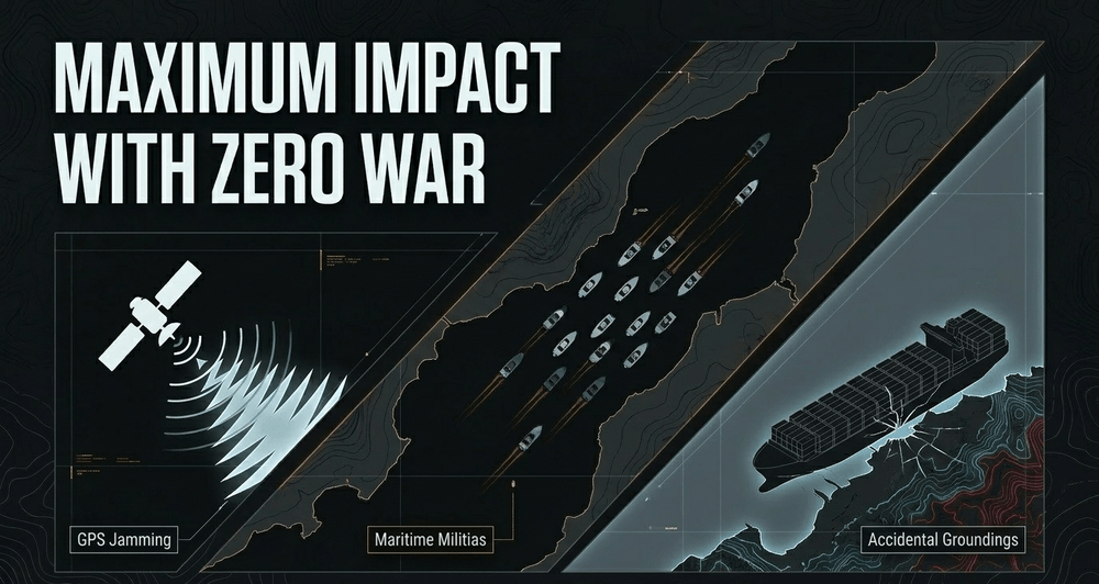
Modern strategic thought has expanded these older frameworks to account for "hybrid action." Because chokepoints are so economically vital, they make ideal environments for activities that fall below the threshold of open war: GPS jamming, the use of maritime militias, or conveniently-timed "accidental" ship groundings. These actions exploit the constrained geography to apply pressure without triggering a full conventional response. The concentrated nature of these spaces means a very small amount of localized disruption can produce a massive, systemic effect across the global economy.
Environmental and technological pressures on traditional routes
The permanence of chokepoints is being tested by two modern forces: climate change and emerging technology - though "permanence" is, so far, winning.
The Panama Canal, which handles roughly 5% of global maritime trade, provides a vivid recent example of environmental vulnerability. A severe multi-year drought driven by El Niño conditions reduced the canal's daily transit capacity dramatically - at the low point, daily crossings fell from the high thirties to below twenty, with vessel draft restrictions adding further delays and cost. The episode forced shippers toward the Suez Canal and the Cape of Good Hope, adding days and significant expense to affected routes. Notably, the canal has since largely recovered: reservoir levels returned to near-capacity by early 2026 and transit volumes have climbed back toward historical norms, though certain cargo segments - particularly LNG carriers, many of which shifted permanently to the Cape route - have been slower to return. The episode demonstrated something important: even an artificially engineered chokepoint remains subject to the whims of the natural world, and the adjustments shippers make during a crisis do not always reverse once the crisis ends.
Separately, the gradual melting of Arctic ice is slowly opening the Northern Sea Route as a viable commercial corridor. While this could eventually offer an alternative to the Suez Canal for some trade between Europe and Asia, it does not eliminate the underlying concept of the chokepoint - it merely relocates it, creating new pinch points such as the Bering Strait. Meanwhile, advances in long-range precision weapons and persistent surveillance have made transiting any of these narrow spaces measurably more dangerous than it was even a decade ago. Rather than rendering chokepoints obsolete, these technological shifts have, if anything, raised the stakes of controlling them.
Conclusion: the eternal map
Chokepoints are the permanent features of a volatile world. They sit at the intersection of physical limits and human necessity, and no amount of digital connectivity has managed to dissolve that intersection. Whether it is the Strait of Hormuz governing the flow of energy to half the planet, the Strait of Malacca holding China's economy hostage to a 2.7-kilometer channel, or the Suwalki Gap defining the outer boundary of Western collective defense, these narrow passages remain among the most consequential coordinates on the global map.
As long as physical goods must move across a physical planet, the geography of chokepoints will remain a primary theater of geopolitical competition - and the events surrounding the Strait of Hormuz in 2026 have made that point with a force that decades of theoretical writing never quite managed. The states and actors that understand the structural logic of these bottlenecks will continue to hold a disproportionate share of global power. Those that ignore them tend to find out why the hard way - usually at the worst possible moment.
Share now









Key takeaways
- A chokepoint is defined by three converging conditions: narrowness, indispensability, and the absence of any practical alternative.
- Chokepoints operate across four planes - physical, economic, informational, and psychological - meaning disruption rarely stays contained to shipping alone.
- The Strait of Hormuz, at its narrowest around 33 km wide, normally carries roughly one-fifth to one-quarter of global oil consumption and about 20% of global LNG trade.
- In 2026, the Strait of Hormuz experienced an extended closure linked to the Iran war - described by energy analysts as the largest oil market supply disruption since the 1973 OPEC embargo, with traffic dropping by more than 90%.
- The Suez Canal handles roughly 10-12% of global trade and around 30% of Asia-Europe container traffic, and was famously blocked for six days by the Ever Given in 2021.
- The Strait of Malacca, narrowing to just 2.7 km at the Phillips Channel, carries a large share of global seaborne trade and roughly 75-80% of China's crude oil imports - the so-called "Malacca Dilemma."
- The Bab-el-Mandeb Strait ("Gate of Tears") is under 30 km wide and has seen repeated attacks on shipping, forcing many vessels to reroute around the Cape of Good Hope.
- The Suwalki Gap, a 40-65 mile strip between Poland and Lithuania flanked by Kaliningrad and Belarus, is the only land corridor connecting the Baltic states to the rest of NATO.
- The Siliguri Corridor ("Chicken's Neck") narrows to roughly 12-17 miles and is the sole land link between India's northeastern states and the rest of the country.
- The Panama Canal (about 5% of global maritime trade) suffered a severe drought-driven capacity cut in 2023-24 but has largely recovered, though LNG transits remain well below pre-drought levels as carriers stick with the Cape route.
Sources
- IEA https://www.iea.org/about/oil-security-and-emergency-response/strait-of-hormuz
- U.S. Energy Information Administration https://www.eia.gov/todayinenergy/detail.php?id=65584
- CSIS https://www.csis.org/analysis/strategic-future-subsea-cables-egypt-case-study
- Wikipedia https://en.wikipedia.org/wiki/Choke_point
- IMF PortWatch https://www.imf.org/Blogs/Articles/2024/03/07/Red-Sea-Attacks-Disrupt-Global-Trade
- Published 2026-06-15 15:24
- Modified 2026-06-15 15:24

-
Redaction


