


-
 Redaction
Enclaves and exclaves: The territorial anomalies
Global maps hide a messy reality of enclaves and exclaves. This analysis breaks down the history, taxonomy and geopolitics of border anomalies.
The map of the world, often presented in schoolbooks as a clean mosaic of distinct colors and solid lines, is in reality a frayed tapestry of historical compromises and cartographic accidents. To look closely at the borders of the modern state system is to encounter the ghost of feudalism, the echoes of colonial cartography, and the stubborn persistence of territorial anomalies known as enclaves and exclaves. These geographic outliers are not merely curiosities for the hobbyist; they represent profound challenges to the Westphalian concept of the contiguous nation-state. They are places where the logic of sovereignty meets the resistance of the earth and the complexity of human history.
Geography is rarely as orderly as the treaties that seek to define it. Territorial anomalies arise when a portion of a state is geographically separated from its main body or entirely surrounded by a foreign power. These spatial irregularities have survived centuries of wars and political consolidations, remaining as artifacts of a bygone era or as strategic outposts in a modern geopolitical landscape. To understand these territories is to understand the fragile nature of international law and the immense human adaptability required to live within a border that is more of a maze than a line.
The foundational taxonomy of territorial anomalies
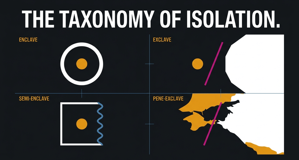
To navigate the study of these regions, one must first master the technical lexicon that defines their spatial existence. While the terms are often used interchangeably in casual discourse, their legal and geographical implications are distinct. According to the foundational definitions provided by scholars like Evgeny Vinokurov in the seminal work A Theory of Enclaves, the distinction hinges entirely on the perspective of the surrounding and parent states.
An enclave is a territory, or a fragment of one, that is entirely surrounded by the territory of a single other state or entity. This is an inward-looking definition. From the perspective of the surrounding state, the territory is a hole in its own fabric. It can be an independent sovereign nation - such as Vatican City, San Marino, or Lesotho - or a piece of a distant foreign power. A true enclave, under the most restrictive definitions of international law, is a territory that cannot be reached without passing through the territory of the surrounding state. There is no coastal access, no international waters, and no alternative land route that does not involve crossing a foreign border.
Conversely, an exclave is an outward-looking definition. It refers to a portion of a state geographically separated from its mainland by the territory of one or more foreign entities. Every enclave that is part of a larger state is, by definition, an exclave to that state. However, not every exclave is an enclave. The Nakhchivan Autonomous Republic is an exclave of Azerbaijan because it is separated from the mainland, but because it borders Armenia, Iran, and Turkey, it is not an enclave; it is surrounded by multiple states rather than one.
The word enclave derives from the Old French enclaver, meaning to enclose, which in turn evolved from the Vulgar Latin inclavare - "to lock up." The etymology is appropriate. For many who have lived within these territories, the border has functioned precisely as advertised: a lock.
The nuances of semi-enclaves and functional exclaves
Beyond these binary definitions lies a spectrum of "semi" and "pene" classifications that account for the presence of water or impractical terrain. A semi-enclave is an area that would be an enclave were it not for a sea border that provides access to international waters. The Republic of The Gambia, surrounded entirely by Senegal except for its Atlantic coastline, serves as a classic example. Monaco and Brunei occupy similar positions, maintaining sovereignty while being nestled into the side of a single larger neighbor. Angola's Cabinda province - bordered by the Democratic Republic of Congo, the Republic of Congo, and the Atlantic - falls into this same category.
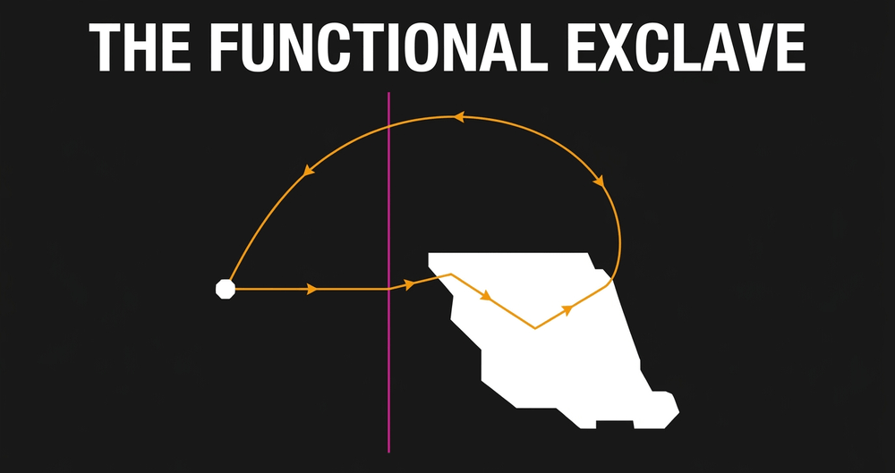
In the realm of practical geography, we find the pene-exclave, also known as a functional or practical exclave. These are territories that are technically contiguous with their parent state via land or water, but which can only be conveniently reached by traveling through another country. Point Roberts in Washington State is a quintessential pene-exclave. While it is part of the United States, it sits at the tip of the Tsawwassen Peninsula, south of the 49th parallel. For a resident to drive to the rest of Washington, they must cross into Canada and then back into the United States.
The Austrian valley of Kleinwalsertal presents a similar case. Technically part of the Vorarlberg region of Austria, it is nestled among mountains that make access from Austrian territory virtually impossible. In practice, the valley's road connections lead only northward into Germany, making it a place where Austrian law governs a community that must travel through a foreign country to buy groceries.
This geographical quirk creates a unique social contract where residents are bound to one nation's laws but to another's infrastructure - a daily negotiation between identity and practicality that most people never have to consider.
Büsingen am Hochrhein: the town Germany refused to lose
Not every exclave begins with a war. Some emerge from spite.
The town of Büsingen am Hochrhein, home to around 1,500 residents on the Upper Rhine, is a German exclave separated from the rest of Germany by no more than 700 meters of Swiss territory at its closest point. Its peculiar status traces back to 1693, when a Swiss court in Schaffhausen kidnapped and imprisoned the local feudal lord, Eberhard Im Thurn. The incident nearly triggered a war between Austria - which then controlled Büsingen - and Switzerland. When Austria later sold surrounding territories to the Swiss canton of Zurich, it held on to Büsingen specifically to deny it to the Swiss. The territory eventually passed through the Grand Duchy of Baden and into the German Empire, and Büsingen has remained German ever since - though in almost every practical sense, it is Swiss.
The enclave was formally defined in 1967, when Büsingen officially entered into a customs union with Switzerland. It is the only place in Germany that does not use the euro as its primary currency. Residents use the Swiss franc for daily transactions. Both Swiss and German postal codes are valid addresses; both countries' telephone prefixes work inside its borders; Swiss police are empowered to arrest German citizens within it. In 1918, after the First World War, 96% of Büsingen's residents voted to join Switzerland. The Swiss Confederation, unwilling to absorb the territory without offering Germany something in return, declined the annexation request. The residents of Büsingen remained German against their own expressed wishes.
One restaurant in the village has an international border painted across its outdoor terrace, marking precisely where German and Swiss territory meet. It is a novelty for tourists. For those who grew up there, it is simply the floor.
The Baarle-Nassau and Baarle-Hertog labyrinth
If one seeks the zenith of territorial complexity, one must look to the border between Belgium and the Netherlands, specifically the municipalities of Baarle-Nassau and Baarle-Hertog. This is not a single enclave but a fractal-like arrangement of 22 Belgian exclaves within the Netherlands, which in turn contain several Dutch counter-enclaves. The result is a town where the border runs through cafes, shops, and private living rooms. Altogether, more than 30 separate international boundary lines cut through the settlement.
This situation is the product of medieval land swaps and feudal treaties dating to the 12th century. The Lords of Breda and the Dukes of Brabant traded parcels of land like chess pieces, and when the modern states of Belgium and the Netherlands were eventually established - Belgium declaring independence in 1830 and the final borders not being formally agreed until 1843 - these ancient property lines became international borders. The enclaves were not officially surveyed and fixed on paper until 1995.
To manage this chaos, residents developed the voordeurregel - the "front door rule." In buildings where the border bisects the structure, the nationality of the occupants is determined by the location of the front door. The exception that proves the rule: one house on Loveren Street was found to have its front door exactly on the border line, and was accordingly given two house numbers - one Belgian, one Dutch.
There are stories of residents relocating their front door by a few meters to change their tax jurisdiction. During the COVID-19 pandemic, the absurdity became vivid in real time: Belgian mask rules applied on one side of a gallery, while Dutch rules applied a few steps away. Diners in a restaurant split by the border had to change tables - not to change the view, but to change the country. While this provides colorful anecdotes for tourists, it presents a constant challenge for local governance. Fire departments, police forces, and waste management services must operate under complex bilateral agreements to ensure that a house fire does not become a diplomatic incident over jurisdictional authority.

The legacy of the Cooch Behar enclaves
While Baarle represents an amicable, if confusing, arrangement, the former enclaves along the India-Bangladesh border in the Cooch Behar district represented something closer to a human rights crisis. This region contained 162 enclaves in total - 111 Indian enclaves within Bangladesh and 51 Bangladeshi enclaves within India - home to an estimated 51,000 people living in legal limbo.
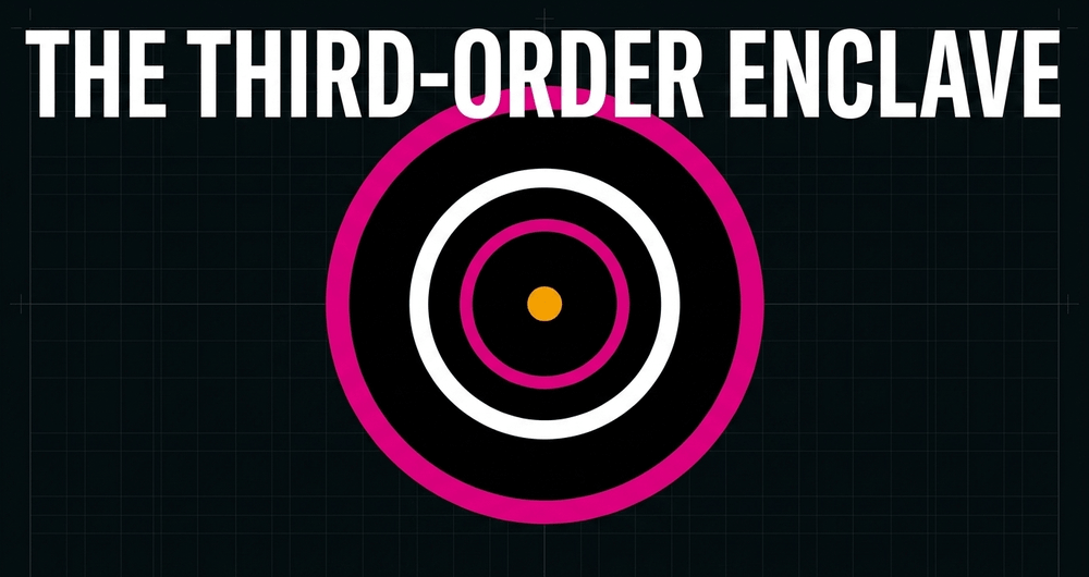
The complexity reached a point of genuine absurdity with the existence of the world's only third-order enclave: Dahala Khagrabari, a roughly 1.7-acre piece of Indian farmland inside a piece of Bangladesh, which was itself inside a piece of India, all within the territory of Bangladesh. Uninhabited and used for jute cultivation by a Bangladeshi farmer who crossed borders daily to reach his own field, the enclave represented the outer limit of what cartographic accidents can produce.
For the residents of these enclaves, geography was a prison. Because they were technically on foreign soil, they were cut off from their own government's services. They had no access to electricity, no police protection, and no legal way to cross the surrounding territory to reach schools or hospitals in their mainland. A resident of an Indian enclave in Bangladesh would be an illegal immigrant the moment they stepped outside their front yard. For decades, these populations lived in a state of statelessness despite having clear national identities.
"History has been made today." - Indian Prime Minister Narendra Modi, on the signing of the Land Boundary Agreement ratification, June 2015
This historical knot was finally untied when the Land Boundary Agreement was implemented, allowing residents to choose their citizenship and effectively straightening a border that had been jagged since the Partition of 1947. An overwhelming 98% of enclave residents chose to remain where they were and take the citizenship of their host country rather than relocate. This resolution remains one of the most significant examples of how diplomatic will can overcome centuries of territorial inertia - and one of the clearest reminders that the people inside these anomalies are rarely consulted when the maps are drawn.
Geopolitics and the strategic exclave: Kaliningrad
In the contemporary era, exclaves often take on a much more serious strategic character. The Kaliningrad Oblast is perhaps the most significant example in the northern hemisphere. Seized by the Soviet Union from Germany at the end of World War II and originally called Königsberg, it was an internal part of the USSR. With the dissolution of the Soviet Union in 1991 and the subsequent entry of Lithuania and Poland into NATO and the European Union, Kaliningrad became a Russian exclave on the Baltic Sea, separated from Moscow by hundreds of kilometers of foreign territory. The oblast covers approximately 15,100 square kilometers and holds a population of around one million.
Sometimes described as the Kremlin's "unsinkable aircraft carrier" in the Baltic Sea, Kaliningrad is one of the most militarized pieces of land in Europe. Russia's Baltic Fleet is based at the port of Baltiysk - the only Russian Baltic port free from ice year-round. Russia has installed Iskander tactical missiles in the region, with a range sufficient to reach major European capitals. Polish Foreign Minister Radoslaw Sikorski stated in 2024 that as many as 100 tactical nuclear warheads may be stored at a facility in the exclave - a claim that analysts have been unable to independently verify, though satellite imagery from 2025 confirmed significant reconstruction and expansion at a suspected nuclear storage site in the oblast, including new fencing and advanced communications infrastructure.
The peculiar political-territorial nature of the Kaliningrad Oblast has been an unpredictable geopolitical dilemma and an obstacle to Euro-Atlantic integration of the Baltic region since 1991. NATO has been gradually bolstering its forces in the region, scaling up eastern-flank battlegroups in Poland and Lithuania, bringing the total number of NATO ground troops in the Baltic region into the tens of thousands.
The so-called Suwałki Gap - a roughly 100-kilometer strip of land along the Polish-Lithuanian border between Kaliningrad and Belarus - has become one of the most analyzed chokepoints in European security. Should this corridor be severed in a conflict, the Baltic states could be cut off from the rest of NATO's land forces. It is a scenario that military planners on both sides study with great attention. This is what an exclave can become when the political temperature rises: not a cartographic footnote, but a potential trigger. Poland has responded with its "East Shield" border fortification program, specifically designed to harden its frontier with Kaliningrad. The relevant article on strategic chokepoints examines how this dynamic - geography as leverage - plays out across the world's most sensitive corridors.

The South Caucasus: Nakhchivan and the corridor question
Similarly, the Nakhchivan Autonomous Republic of Azerbaijan remains a volatile exclave. Separated from the mainland of Azerbaijan by Armenian territory, its isolation has been a core component of the prolonged conflict over Nagorno-Karabakh. Soviet-era railways that once connected Nakhchivan to the rest of Azerbaijan through Armenia were severed in the early 1990s during the first Karabakh war, leaving the exclave dependent on links through Turkey and Iran to remain economically viable.
The struggle to establish a land link between mainland Azerbaijan and Nakhchivan has remained one of the most contentious issues in the South Caucasus. In August 2025, Armenia and Azerbaijan signed a landmark peace agreement at the White House, brokered by U.S. President Donald Trump. Central to the deal is a transit corridor through Armenia's Syunik region - referred to by Azerbaijan and Turkey as the Zangezur Corridor, formally renamed under the accord the Trump Route for International Peace and Prosperity (TRIPP). Under the terms of the agreement, Armenia retains sovereignty over the route, while the United States secured rights to develop and manage the corridor through a private consortium for 99 years. Azerbaijan also lifted its long-standing economic blockade on Armenia as part of the normalization process.
The deal carries implications beyond the South Caucasus. The corridor forms a critical missing link in the so-called Middle Corridor - a trade route connecting China and Central Asia to Turkey and Europe - and its opening is projected to carry up to 15 million tonnes of cargo annually once constructed. Iran and Russia, both of which previously served as alternative transit options for Nakhchivan, have viewed the agreement with considerable alarm, seeing the 99-year U.S. management rights as an encroachment on their regional influence.
The situation illustrates a broader truth about exclaves in contested regions: they do not merely generate diplomatic friction. They become the physical expression of unresolved historical grievances, and the corridor required to sustain them can be as contested as the territory itself.
The economic and social cost of isolation
Living in an enclave or exclave is rarely a matter of geographical indifference. The economic implications of being disconnected from the mainland are profound. Markets are smaller, supply chains are longer, and the cost of basic goods is often higher due to transit fees and customs duties.
In the Fergana Valley, a region shared by Uzbekistan, Kyrgyzstan, and Tajikistan, the presence of several small enclaves has stifled economic development for decades. The valley contains six enclaves in total - four Uzbek enclaves within Kyrgyzstan and two Tajik enclaves within Kyrgyzstan - the product of Stalin's National Territorial Delimitation policy, which was designed not to reflect ethnic or geographic realities but to fragment populations and weaken any potential nationalist opposition to Soviet rule. The constant need to cross borders to reach grazing land or water sources has led to localized disputes and a general state of underdevelopment compared to the surrounding regions. The enclave dwellers of this valley have never made international headlines. They rarely do.
In March 2025, however, the presidents of Kyrgyzstan, Tajikistan, and Uzbekistan signed the Khujand Treaty - a landmark border agreement that resolved decades of competing claims at the tripartite junction of the three states' borders. The agreement represented the most significant progress in Central Asian border diplomacy since independence. Whether the underlying tensions that animate the Fergana enclaves will follow remains an open question.
Socially, enclave dwellers often develop what researchers describe as a heightened attachment to national identity. When surrounded by a "foreign" entity, the preservation of language, religion, and custom becomes a defensive act. This can lead to the creation of cultural time capsules.
Consider Campione d'Italia, an Italian exclave of 2.68 square kilometers nestled within the Swiss canton of Ticino, on the shores of Lake Lugano. For most of its modern history, Campione operated in de facto Swiss customs territory - Swiss francs were used alongside the euro, Swiss providers handled waste collection and telecommunications, and residents enjoyed a VAT rate far below Italy's own. Italian dictator Benito Mussolini added the suffix d'Italia to the town's name in the 1930s, a deliberate act of nationalistic assertion toward a community whose everyday life was thoroughly Swiss. The enclave was formally incorporated into the EU customs territory in 2020, a change its residents largely opposed - a rare instance of a community protesting its return to the European mainstream.
As Nies observed in a study for World Finance: "When it comes to enclaves, everything is foreign policy. Enclaves are micro-entities with a political history distinct both from that of the heartland they belong to and the enclaving states surrounding them. They are often symbols of victory, and states will do everything to control their trophy."
The economics of Campione are instructive. The town's main economic engine for over a century was the Casinò di Campione, one of Europe's largest casinos, founded in 1917. The casino was declared bankrupt in July 2018 - the municipality had accumulated some 130 million euros in debt, partly due to the absence of revenue transfers from the gambling operation. Some 482 casino employees were dismissed overnight. Municipal workers went without pay. The kindergarten closed. After a protracted legal process, the casino eventually reopened in January 2022. But the damage to the enclave's finances, compounded by the 2020 customs change that eliminated its special tax advantages, demonstrated how precarious the financial foundations of a small exclave can be when they rest on a single industry. Strip away the casino, and what remains is a beautiful village on a lake, with a complex legal status and a population of fewer than 2,000 people navigating two sets of rules simultaneously.
The fragility of the enclave in times of crisis
Events like the COVID-19 pandemic revealed the inherent vulnerability of territorial anomalies in stark terms. When nations closed their borders to contain the virus, enclave residents found themselves trapped. In some cases, the surrounding state's lockdowns prevented enclave dwellers from reaching essential services in their own country. The pandemic highlighted that the "functional" nature of these borders relies entirely on the goodwill of neighbors and the stability of international treaties.
The distinction between a border that is a legal concept and a border that is a physical barrier became impossible to ignore. In Baarle, different mask mandates applied across a gallery floor. In enclaves where emergency services were provided by the surrounding state, residents discovered that in a public health emergency, mutual arrangements could be suspended without notice.
In North Africa, the Spanish semi-exclaves of Ceuta and Melilla provide a different kind of pressure point. These cities, located on the Moroccan coast, represent the only land borders between the European Union and Africa. Consequently, they have become magnets for migration and persistent flashpoints in Spanish-Moroccan relations. The physical barriers built around these cities - Melilla's border is fortified with multiple layers of fencing, concrete walls, ditches, and barbed wire, renovations completed in March 2024 - are a stark reminder that an exclave is not just a line on a map.
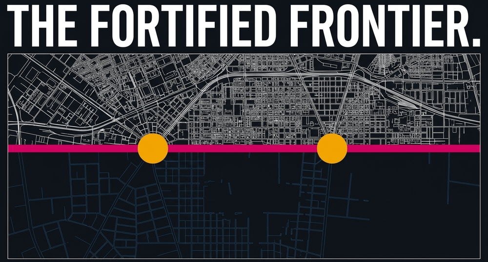
The 2021 Ceuta crisis exemplified the capacity of border management to become a diplomatic instrument: Morocco relaxed its border controls, enabling thousands of migrants to cross into Spain, as retaliation for Spain's support of Polisario leader Brahim Ghali. The population of sub-Saharan Africa and North Africa seeking passage into Europe does not see a Spanish exclave when they look at Ceuta and Melilla. They see a door into the European Union. And Morocco, which controls the access routes to that door, has learned that border management in this context is a form of leverage. This is the geopolitics of the exclave compressed into a fence.
Guantánamo and the question of leased sovereignty
Not all territorial anomalies follow from medieval land swaps or the dissolution of empires. Some are the product of deliberate treaties with their own peculiar terms. Guantánamo Bay Naval Base, spanning approximately 45 square miles on the southeastern coast of Cuba, has been leased to the United States since 1903. The lease was signed as part of the Cuban-American Treaty by President Theodore Roosevelt, providing the United States with "complete jurisdiction and control" of the base in exchange for approximately $4,085 annually - originally set as 2,000 gold coins. Cuba has largely refused to collect payment since 1959. On one occasion, Fidel Castro reportedly cashed a single check by accident and later admitted it in writing.
Cuba maintains that the lease was signed under coercion and that the base constitutes illegal occupation; the United States continues to operate it regardless. The lease can only be terminated with the mutual consent of both parties - a provision that has effectively made the arrangement permanent without either side being able to force the issue.
Guantánamo occupies a grey zone not just geographically but legally. Courts in the United States have grappled for decades with the question of which laws apply within its fences. The base is not U.S. territory, yet it is administered by the U.S. military. It is Cuban territory, yet Cuba exercises no authority there. In 2008, the U.S. Supreme Court ruled in Boumediene v. Bush that detainees held at Guantánamo do have the right to habeas corpus - a ruling that implicitly acknowledged the base's role as a jurisdictional grey zone. It is, in a sense, a legal enclave within an already anomalous political situation.
The case illustrates how the concept of the enclave can extend beyond simple geography. Sovereignty, it turns out, can also be rented.
The broader question of how states exercise power beyond their borders - through sanctions, legal jurisdiction, and international agreements - is examined in the related article on extraterritoriality, which provides a useful complement to the enclave question.
Academic perspectives on the life cycle of enclaves
Scholars of political geography suggest that enclaves are rarely permanent in the long arc of history. They tend to follow a life cycle of emergence, maturation, and eventual disappearance. Most are products of the fragmentation of empires or the complex settlements of peace treaties. As the world becomes more integrated through economic unions like the EU, the friction of the border may decrease, but the legal anomaly remains.
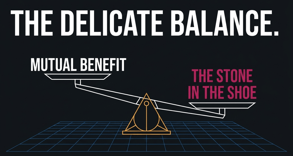
Vinokurov notes that for an enclave to survive, it must maintain a delicate balance with its "host" state. If the enclave becomes too much of a "stone in the shoe" for the surrounding country, pressure for its annexation or elimination grows. Successful enclaves are those that offer a mutual benefit to both the parent state and the host - such as the duty-free status that Campione d'Italia enjoyed for decades, or the historical status of West Berlin as a symbol of Western democratic resolve during the Cold War. Enclaves that exist only as an inconvenience, or as a military flashpoint, face a more precarious future.
The future of territorial anomalies
In an era of increasing globalization, one might expect territorial anomalies to vanish. Yet the opposite is often true. As new nations gain independence and old ones fracture, new enclaves are created. The dissolution of the Soviet Union alone created dozens of new international enclaves overnight. The persistence of these territories suggests that land remains the ultimate currency of sovereignty, and states are rarely willing to surrender even the most inconvenient scrap of it.
The past decade has seen both resolution and entrenchment. India and Bangladesh exchanged 162 enclaves in 2015, ending statelessness for tens of thousands of people. The Khujand Treaty of 2025 moved Central Asia's Fergana Valley closer to clarity after three decades of post-Soviet ambiguity. The Armenia-Azerbaijan peace agreement of August 2025 addressed the most volatile exclave corridor in the former Soviet space. Each of these resolutions required years of diplomacy and, in some cases, a fundamental reordering of regional power dynamics to make them possible.
As we move further into the 21st century, the management of these regions will require innovative diplomatic solutions. The traditional model of the contiguous state may need to give way to more flexible concepts of shared sovereignty and cross-border cooperation. Whether through land swaps, as seen in the India-Bangladesh exchange, or through the "invisible" borders of the Schengen Area, the goal remains the same: to ensure that the people living within these geographical quirks are not punished for the accidents of history.
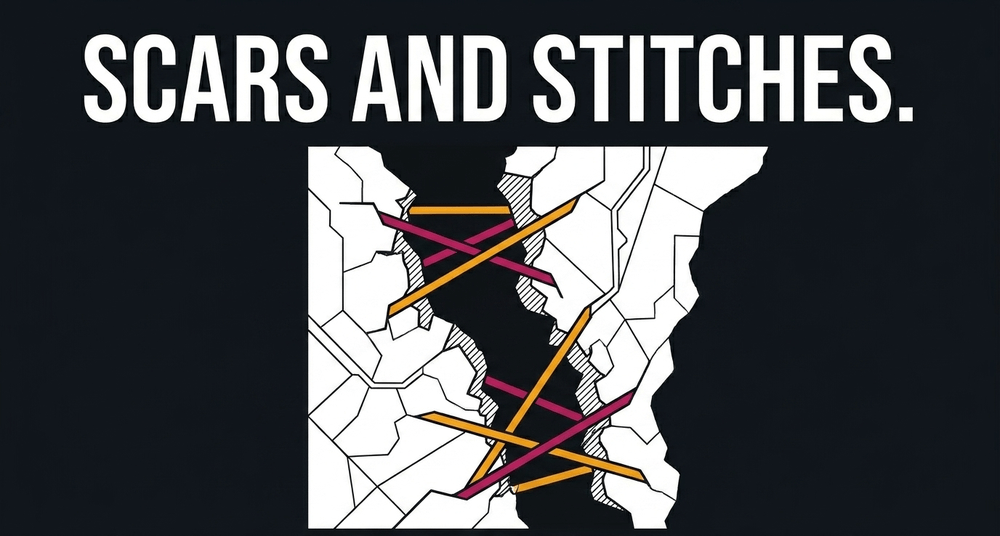
Enclaves and exclaves remind us that history is never truly finished. They are the scars and stitches of the global map, proving that the world we inhabit is far more complex and layered than any single line on a map can convey. To respect the enclave is to respect the enduring, often messy, reality of human geography. And to understand the people inside them is to understand something that schoolbook maps have always refused to show: that the neatest lines are almost always drawn by people who do not have to live along them.
Key facts
- An enclave is territory entirely surrounded by a single foreign state; an exclave is a portion of a state geographically separated from its mainland by foreign territory. Every enclave belonging to a larger state is also an exclave, but not every exclave is an enclave.
- The only three fully sovereign enclave nations in the world are Vatican City and San Marino (both surrounded by Italy) and Lesotho (surrounded by South Africa).
- The Baarle-Nassau and Baarle-Hertog complex between the Netherlands and Belgium features 22 Belgian exclaves within Dutch territory, with more than 30 international boundary lines running through streets, shops, and private homes. The borders were only formally fixed on paper in 1995.
- The "front door rule" (voordeurregel) in Baarle determines a building's national identity by where its front door is located. One house with its door exactly on the border was given two house numbers - one Belgian, one Dutch.
- In 2015, India and Bangladesh resolved 162 enclaves through the Land Boundary Agreement - 111 Indian enclaves within Bangladesh and 51 Bangladeshi enclaves within India - ending statelessness for around 51,000 people. An estimated 98% of residents chose to remain where they were and take citizenship of the surrounding country.
- Dahala Khagrabari was the world's only third-order enclave: a 1.7-acre piece of Indian farmland inside a Bangladeshi enclave, inside an Indian enclave, all within Bangladesh. It was ceded to Bangladesh in 2015.
- Kaliningrad Oblast, Russia's exclave on the Baltic Sea, covers approximately 15,100 square kilometers and hosts a population of around one million. Entirely surrounded by NATO members Poland and Lithuania, it hosts Russia's only ice-free Baltic port and is one of the most militarized territories in Europe.
- The Suwałki Gap - a roughly 100-kilometer stretch of land along the Polish-Lithuanian border between Kaliningrad and Belarus - is considered one of the most strategically sensitive chokepoints in European security.
- In August 2025, Armenia and Azerbaijan signed a US-brokered peace agreement establishing the Trump Route for International Peace and Prosperity (TRIPP) - a transit corridor through Armenia connecting mainland Azerbaijan with its Nakhchivan exclave, to be developed and managed by the United States for 99 years.
- Guantánamo Bay Naval Base has been leased to the United States by Cuba since 1903 at a rate of approximately $4,085 per year - a sum Cuba has almost entirely refused to collect since 1959, reportedly cashing only one check, by accident.
Share now









Key takeaways
- An enclave is territory entirely surrounded by a single foreign state; an exclave is a portion of a state separated from its mainland by foreign territory. Every enclave belonging to a larger state is also an exclave, but not every exclave is an enclave.
- The only three fully sovereign enclave nations in the world are Vatican City and San Marino (both surrounded by Italy) and Lesotho (surrounded by South Africa).
- The Baarle-Nassau and Baarle-Hertog complex between the Netherlands and Belgium features 22 Belgian exclaves within Dutch territory, with more than 30 international boundary lines running through streets, shops, and private homes. The borders were only formally fixed on paper in 1995.
- The "front door rule" (voordeurregel) in Baarle determines a building's national identity by where its front door is located. One house with its door exactly on the border line was given two house numbers - one Belgian, one Dutch.
- In 2015, India and Bangladesh resolved 162 enclaves through the Land Boundary Agreement - 111 Indian enclaves within Bangladesh and 51 Bangladeshi enclaves within India - ending statelessness for around 51,000 people. An estimated 98% of residents chose to remain where they were and take citizenship of the surrounding country.
- Dahala Khagrabari was the world's only third-order enclave: a 1.7-acre piece of Indian farmland inside a Bangladeshi enclave, inside an Indian enclave, all within Bangladesh. It was ceded to Bangladesh in 2015.
- Kaliningrad Oblast, Russia's exclave on the Baltic Sea, covers approximately 15,100 square kilometers and hosts a population of around 1 million. Entirely surrounded by NATO members Poland and Lithuania, it is described as one of the most militarized territories in Europe and hosts Russia's only ice-free Baltic port.
- The Suwałki Gap - a roughly 100-kilometer stretch of land along the Polish-Lithuanian border between Kaliningrad and Belarus - is considered one of the most strategically sensitive chokepoints in European security.
- Campione d'Italia, an Italian exclave of 2.68 km² surrounded by the Swiss canton of Ticino, operated de facto within Swiss customs territory for over 150 years before being formally incorporated into the EU customs area in 2020 - a change its residents largely opposed.
- Ceuta and Melilla, Spanish semi-exclaves on the Moroccan coast, are the only land borders between the European Union and Africa, making them persistent flashpoints for migration and Spanish-Moroccan diplomatic tensions.
- The Nakhchivan Autonomous Republic of Azerbaijan - separated from mainland Azerbaijan by Armenian territory - has been at the center of South Caucasus geopolitics for decades, with a proposed 43-kilometer land corridor through Armenia remaining one of the most contested connectivity projects in the region.
- Guantánamo Bay Naval Base has been leased to the United States by Cuba since 1903 at a rate of approximately $4,085 per year - a sum Cuba has largely refused to collect since 1959.
Sources
- Wikipedia: Enclave and exclave https://en.wikipedia.org/wiki/Enclave_and_exclave
- U.S. Naval Institute Proceedings: The Strategic Relevance of Kaliningrad https://www.usni.org/magazines/proceedings/2024/october/strategic-relevance-kaliningrad
- Migration Policy Institute: India and Bangladesh Swap Territory, Citizens in Landmark Enclave Exchange https://www.migrationpolicy.org/article/india-and-bangladesh-swap-territory-citizens-landmark-enclave-exchange
- Wikipedia: Dahala Khagrabari https://en.wikipedia.org/wiki/Dahala_Khagrabari
- World Finance: The economics of exclaves https://www.worldfinance.com/markets/separate-from-the-rest
- Published 2026-06-17 15:18
- Modified 2026-06-17 15:18

-
Redaction


