# Satellite spy tech and the end of surprise attacks
- Category: **Wars & Defense > Military Technology**
- Publisher: **Psyll Magazine** - [https://psyll.com](https://psyll.com)
- Author: **Harley Mills** - [https://psyll.com/harley](https://psyll.com/harley)
- Original article: [https://psyll.com/articles/wars-defense/military-technology/satellite-spy-tech-and-the-end-of-surprise-attacks](https://psyll.com/articles/wars-defense/military-technology/satellite-spy-tech-and-the-end-of-surprise-attacks)
---
**From Cold War film capsules to AI-driven satellites, discover how orbital reconnaissance reshaped warfare, troop movements, and the meaning of surprise today. **
---
## The glass battlefield and the cost of visibility
Imagine a commander huddled over a paper map in a rain-slicked tent, gambling thousands of lives on the hope that the enemy cannot see through the fog or the forest. For millennia, the heartbeat of warfare was the secret. The flank, the midnight march, and the hidden reserve were the tools of the master strategist. Today, that commander's gamble is no longer against the fog, but against a cold, unblinking eye orbiting hundreds of kilometers overhead. Satellite reconnaissance has become the defining reality of the modern battlefield, turning the earth into something like a glass bowl where movement is indexed, analyzed, and shared in near-real-time.
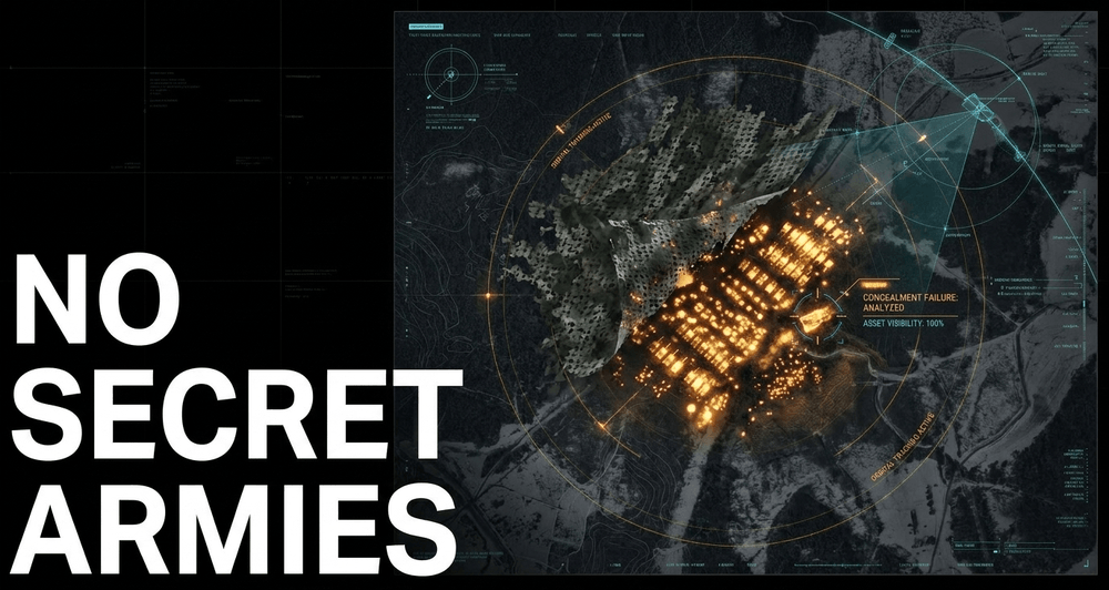
The shift is visceral. In the lead-up to the 2022 invasion of Ukraine, the world watched via commercial satellite imagery as Russian tank battalions massed in the snow-dusted forests of Belarus. There was no secret maneuver, no hidden assembly - just rows of armor sitting in open fields for anyone with an internet connection to count. The opacity that once defined military operations has been cracking apart for decades, and that crack has now become a chasm. We have entered an era where the very phrase "surprise attack" feels almost like a contradiction, replaced by a grueling competition of transparency and rapid response.
*Have a question about how this all connects? Drop it in the comments - I read every one of them.*
## From film canisters to digital dominance
The journey to this transparency began in the desperate early days of the Cold War. Fearing a "missile gap" and unable to peer into the impenetrable Soviet interior, the United States approved the Weapon System 117L program in 1956. This initiative, which eventually evolved into the Corona program, was a feat of engineering that bordered on the impossible for its era. By 1958, the program was fueled by tens of millions of dollars in funding - a sum that, adjusted for inflation, would represent close to a billion dollars today, reflecting just how existential the need to see over the horizon had become.
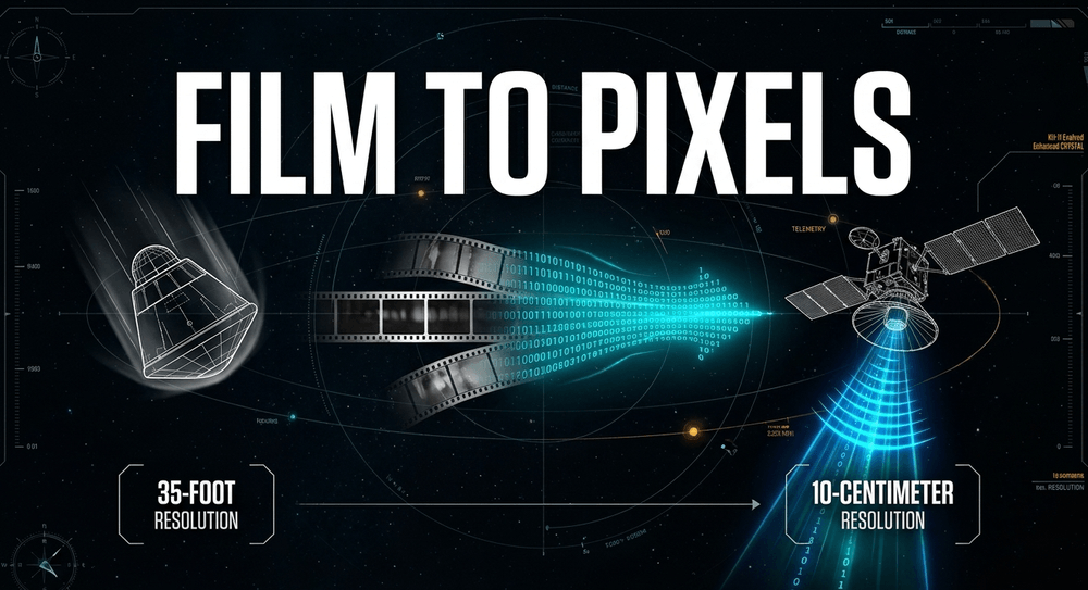
Those early days were anything but digital. The Corona satellites were essentially giant orbiting cameras loaded with high-quality film. Once the film was spent, the satellite would eject a heat-shielded capsule that plummeted back through the atmosphere on a parachute. Air Force pilots, flying specially modified C-119 "Flying Boxcar" aircraft equipped with recovery hooks, would attempt to literally snag these "buckets" of film in mid-air over the Pacific. It took several tries and more than a dozen failed missions before it worked.
The first successful recovery came on August 18-19, 1960, when a C-119 from the 6593rd Test Squadron caught the parachute of the Discoverer XIV capsule on its third attempt, 360 miles southwest of Hawaii. The mission yielded images covering more than 1.65 million square miles of Soviet territory - more than every previous U-2 spy plane flight combined. The resolution was roughly 40 feet, good enough to identify a runway or an airfield, but nowhere near sharp enough to make out a vehicle.
Evolution from there was rapid, almost breathless. The early KH-1 through KH-4 Corona cameras improved from 40-foot resolution down to roughly 5-7 feet by the program's final flights in 1972. The KH-7 GAMBIT series, flying through the mid-1960s, pushed resolution down to 2-4 feet. By the time the KH-8 GAMBIT 3 and KH-9 HEXAGON systems were operating in the 1970s, analysts were working with imagery sharp enough to identify individual vehicles and equipment with confidence.
The real game-changer arrived with the KH-11 KENNEN, first launched in December 1976. It replaced film with electro-optical digital sensors, relayed via the Satellite Data System to ground stations. The delay between capturing an image and an analyst viewing it dropped from days or weeks to a matter of minutes. It was, in a very real sense, the birth of the "live feed" in military intelligence - and it set the template for everything that followed.
## The modern panopticon and the commercial revolution
Today, the descendants of the KH-11 - sometimes referred to as the Evolved Enhanced CRYSTAL System - represent the pinnacle of electro-optical surveillance. These platforms are believed to carry primary mirrors in the 2.4 to 3-meter range, broadly comparable in scale to the Hubble Space Telescope, but pointed downward instead of toward the stars. Analysts and independent researchers have estimated theoretical ground resolutions in the range of 10-15 centimeters under ideal conditions, though the US government has never officially confirmed exact figures, and atmospheric distortion means real-world performance is typically somewhat coarser. The United States operates a constellation of these satellites, and China, Russia, and France maintain their own high-resolution reconnaissance fleets.
*Quick aside - if you've ever wondered why these things look like inverted space telescopes, it's because, structurally, that's basically what they are. Same optics, same mirror geometry, just aimed at the ground instead of the cosmos.*
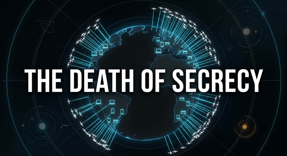
However, the truly disruptive shift of the last decade hasn't come from these multi-billion-dollar government platforms. It has come from the commercial sector. Companies like Planet Labs and Vantor have, in effect, democratized intelligence that used to be a closely guarded crown jewel of the state. During the Gulf War, high-resolution satellite imagery was something only a handful of governments could access. Now, a journalist or a graduate student with a credit card can track a carrier strike group or count aircraft on a tarmac on the other side of the world. This commercial proliferation has created what some analysts have started calling the "death of secrecy." When thousands of small satellites are crossing overhead every day, someone is almost always watching.
That openness, though, has run into a wall. In early 2026, amid the escalating conflict involving Iran, the commercial satellite operator Planet Labs - under pressure from the US government's "shutter control" authority embedded in commercial remote-sensing licenses - moved from an initial short delay to a 14-day hold, and then to an indefinite "managed access" blackout on high-resolution imagery of Iran and the surrounding conflict zone, [retroactive to early March 2026](https://www.cjr.org/feature/blind-spots-satellite-osint-open-source-middle-east-iran-blackout-planet-labs-vantor-maxar.php). It was one of the most aggressive uses of shutter control authority in years, and it highlighted the double-edged nature of this technology. The same imagery that brings transparency to a conflict can also be used by adversaries to conduct their own battle damage assessments and adjust their operations accordingly - which is precisely the tension the US government cited in justifying the restriction.
## Why tactical surprise is struggling to survive
The most immediate casualty of this technological surge is the massive troop movement. Historically, a general could hide a corps in a forest, or use a storm to mask a naval transit under cover of bad weather. Today, the thermal signature of an idling tank column and the wake trail of a destroyer are visible even through darkness and through a surprising amount of bad weather. Satellite reconnaissance has fundamentally reduced the opacity of the battlefield, and a few consequences stand out:
- **Persistent observation.** Modern satellite constellations, taken together, provide something approaching a persistent stare over key regions. A significant shift in military posture is now likely to be detected within hours rather than days.
- **Deterrence and verification.** Much as Corona imagery helped dispel the exaggerated "missile gap" fears of the early 1960s, satellite imagery today plays a quiet but crucial role in arms control verification - providing a degree of objective truth in situations otherwise dominated by competing claims and propaganda.
- **The end of massing unnoticed.** It is extraordinarily difficult to assemble a large force for a major offensive without the world knowing about it well in advance. The buildup before the 2022 invasion of Ukraine is the textbook case - months of visible warning meant that the only real variable left was political will, not military secrecy.
As one analyst put it in a piece examining this shift for the Center for Strategic and International Studies, the open availability of overhead imagery has made the challenge of achieving strategic surprise fundamentally different than it was even a generation ago
## The friction of the heavens: constraints on space power
Despite the power of the "eye in the sky," space-based intelligence is far from infallible. Several physical and operational constraints still allow for narrow windows of opportunity - and a clever adversary can sometimes find them.
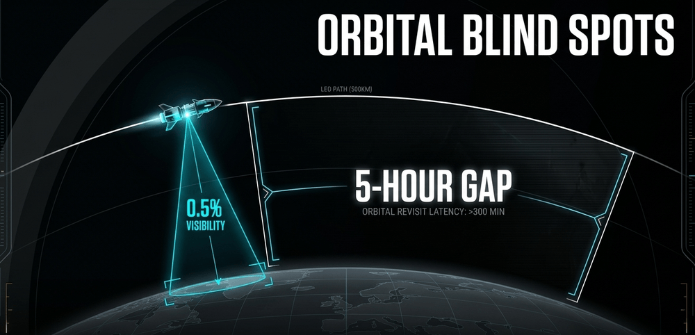
One of the most significant constraints is simply the nature of low Earth orbit. A satellite orbiting at a few hundred kilometers altitude is moving extremely fast - it cannot loiter, cannot hover, cannot circle back for a second look on a whim. Depending on the satellite and the target, the window of useful observation over any single point on the ground can be quite brief, leaving gaps of hours where a determined adversary might move assets, camouflage them, or simply wait it out.
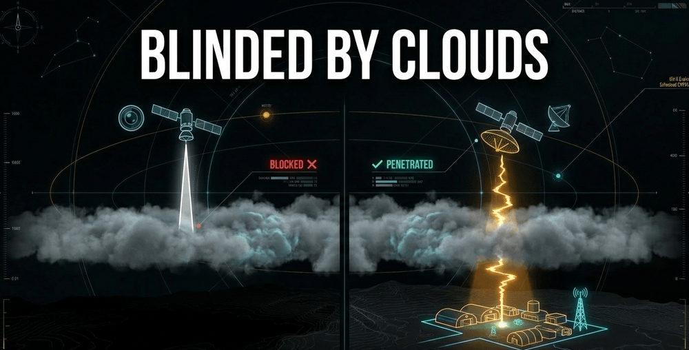
Environmental factors remain a stubborn foe as well. While Synthetic Aperture Radar can see through clouds and operate at night, traditional optical imaging is still blinded by heavy weather. During the Gulf War, coalition forces were at times forced to rely heavily on radar imaging satellites because cloud cover over the theater neutralized much of the available optical collection. That same basic limitation hasn't gone away - it's just been partially offset by having far more sensors of different types in orbit at once.
The dissemination of imagery has also historically been a bottleneck. Traditionally, imagery flowed to a central headquarters, was reviewed and analyzed by specialists, and only then was filtered down to units on the front line. That process could take days - which meant the intelligence was often stale by the time a soldier in the field actually saw it.
> "It is money, it is time." - a Ukrainian soldier describing what direct satellite access saves on the front line, as reported by the Wall Street Journal
Adversaries, naturally, fight back with deception. Decoys, advanced camouflage netting, and electronic "spoofing" techniques are all used to feed satellites and their operators false information. And in any full-scale conflict between major powers, satellites themselves would almost certainly be early targets. The US Department of Defense has openly acknowledged that communications and reconnaissance satellites are considered prime targets for anti-satellite weapons and electronic jamming. A war that begins with high-tech clarity could, in theory, quickly descend into something much closer to a blind, kinetic slugfest if orbital infrastructure were seriously degraded.
## New frontiers: the direct-to-soldier revolution
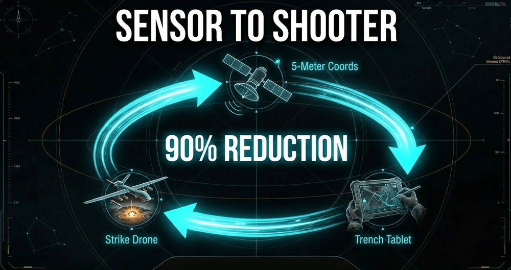
The most exciting - and, depending on your perspective, the most unsettling - evolution underway right now is the rapid closing of what's known in military jargon as the "sensor-to-shooter" cycle: the time between spotting a target and actually striking it.
In the ongoing war in Ukraine, this cycle has reportedly been compressed by as much as 90 percent in certain frontline units. Commercial satellite imagery - in this case from the operator Vantor, working alongside the Dutch firm Bravo1Alpha, the US company Persistent Systems, and Ukraine's own Burevii - is being sent directly to soldiers on tablets and smartphones, bypassing the traditional, slower review process in Kyiv entirely. In one widely reported case, a small Ukrainian unit used this imagery to spot armored vehicles hidden under thick spring foliage and coordinate a drone strike on a Russian command post within days of first detection. Images that once took hours or days to reach a unit through official channels can now arrive in as little as fifteen minutes.
A soldier in a trench can pull up a freshly captured satellite image showing a tank hidden in the treeline behind enemy lines and call in a strike within minutes of that image being taken. It's a genuinely new capability, and one that didn't exist in any meaningful sense even five years ago.
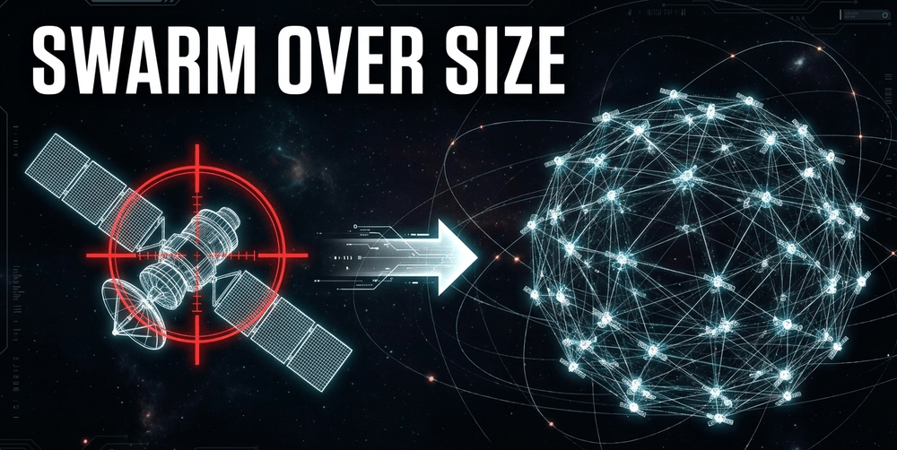
To sustain and expand this capability, the United States has been shifting toward what it calls "proliferated constellations." Instead of relying on a handful of massive, exquisite, billion-dollar satellites, the National Reconnaissance Office has been launching a much larger number of smaller, cheaper satellites built on SpaceX's Starshield platform - a government-focused variant of the Starlink bus. By mid-2026, the NRO had conducted more than a dozen launches supporting this "proliferated architecture" since the program began in 2024, with the NRO itself describing the effort as building "the largest government constellation in history." The strategic logic is straightforward: lose one or two satellites in this kind of swarm, and the rest of the network keeps functioning. Lose a single legacy KH-11, and you've lost a sizable fraction of an entire capability overnight.
## The role of AI and the future of prediction
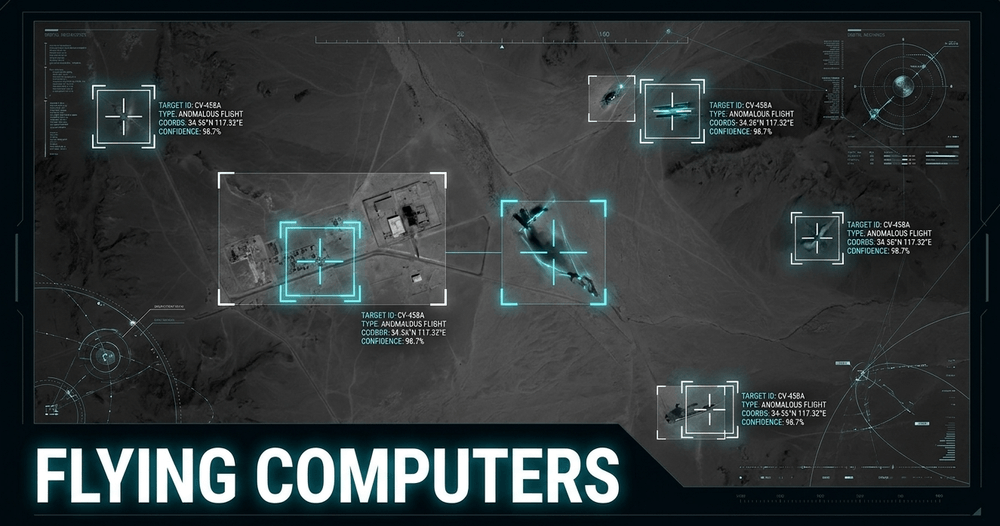
As the sheer volume of imagery from hundreds of satellites continues to climb, human analysts simply cannot keep pace on their own - there aren't enough eyeballs, and there never will be. This has driven the rapid integration of artificial intelligence and machine learning, both on the ground and increasingly onboard the satellites themselves. Modern reconnaissance satellites are no longer just cameras; in a meaningful sense, they're becoming flying computers.
These systems use AI to sift through enormous volumes of imagery automatically, flagging anomalies that a human analyst might take hours to find - a new structure appearing where there wasn't one before, an unusual pattern of aircraft movement at an airbase, or a vehicle convoy forming in an area with no prior activity.
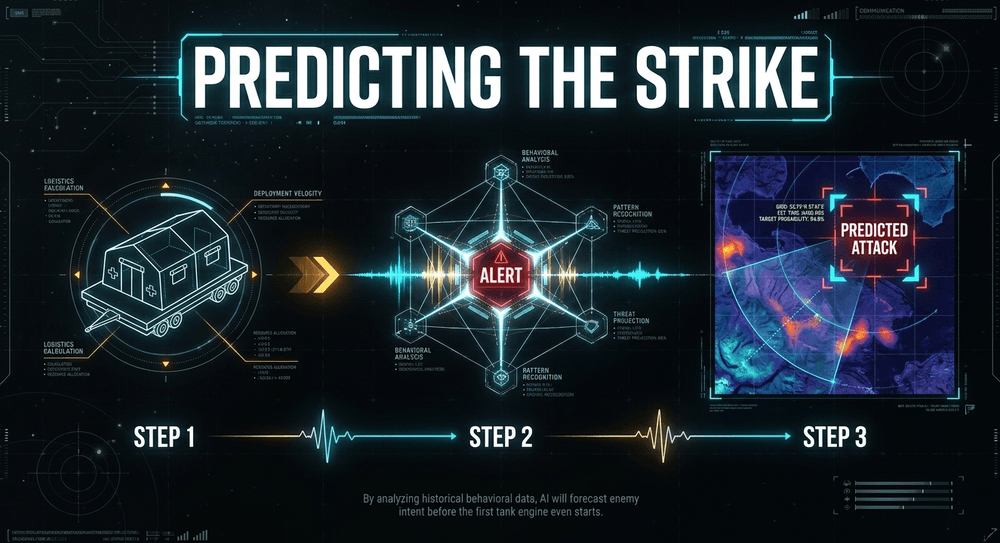
Looking further ahead, the goal is predictive intelligence rather than purely reactive intelligence. By analyzing years of accumulated behavioral data, AI systems may eventually be able to flag the early signs of a military operation before it's fully underway - for instance, if historical patterns show that a particular unit always relocates its medical tents a day or two before a major exercise, an AI system could flag that movement the moment it happens, well before any tanks start their engines.
## Survival in the age of transparency
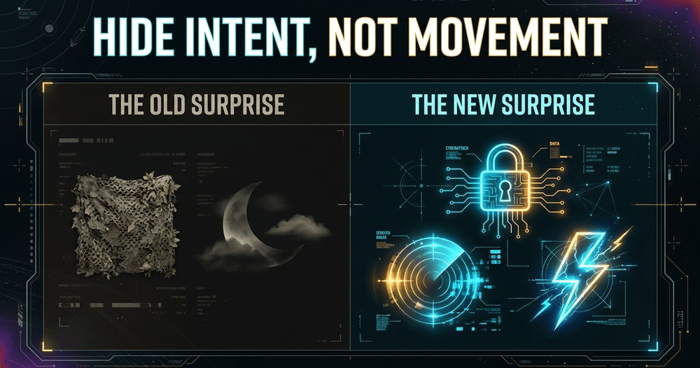
So does all this mean the end of surprise in warfare altogether? Not quite. It simply means the *nature* of surprise has changed. If you can't hide your movement, the logic goes, you have to hide your intent instead. The new tactical surprise is achieved less through camouflage and more through speed, information warfare, and cyber operations. A commander might allow the enemy to see their armor perfectly clearly, while using deception or misinformation to convince that enemy the deployment is a routine drill - right up until the moment the operation actually begins.
The battlefield is no longer a place of shadows in the way it once was. In many respects, it has become a place of almost blinding light. The advantage in the next major conflict may not go to whoever hides best, but to whoever can process the overwhelming flood of visible data the fastest - and act on it before the other side does. Tactical surprise isn't dead. It has simply moved house - from the physical world of camouflage nets and night marches into the digital realm of decision-making measured in seconds.
*This is a topic that's still rapidly evolving - if you've got thoughts on where this goes next, or examples I should dig into for a follow-up, let me know in the comments below.*
## Key takeaways:
* The **Corona program**, approved in 1956 as Weapon System 117L, was the first major US satellite reconnaissance effort and used film capsules physically caught mid-air by aircraft.
* The first successful Corona recovery (Discoverer XIV, August 1960) returned imagery covering *over 1.65 million square miles* of Soviet territory - more than all prior U-2 flights combined.
* Early Corona imagery had a resolution of roughly *40 feet*; by the program's end in 1972, later Corona variants had improved this to roughly *5-7 feet*.
* The **KH-11 KENNEN**, first launched in 1976, was the first US satellite to use digital electro-optical sensors, cutting the image delivery delay from weeks to minutes.
* Modern KH-11-derived satellites are believed to use mirrors in the *2.4 to 3-meter* range, with theoretical resolutions estimated around *10-15 cm* \- though exact figures remain officially classified\.
* Commercial operators like **Planet Labs** and **Vantor** have made high-resolution satellite imagery accessible to journalists, researchers, and the public, not just governments.
* In early 2026, the US government invoked "shutter control" to push Planet Labs toward an *indefinite blackout* of high-resolution Iran imagery, retroactive to March 9, 2026.
* In Ukraine, direct-to-soldier satellite imagery delivery has cut the time to locate and strike targets by *up to 90%*, with some imagery reaching soldiers' devices in as little as 15 minutes.
* The US National Reconnaissance Office has launched over a dozen "proliferated architecture" missions on SpaceX's Starshield platform since 2024, aiming to build a much larger, more resilient satellite constellation.
* Satellites in low Earth orbit move too fast to hover, creating observation gaps that adversaries can sometimes exploit, while cloud cover still limits optical (though not radar) imaging.
## Sources:
* CSIS - The challenge of military surprise in an open world - [https://www.csis.org/analysis/challenge-military-surprise-open-world](https://www.csis.org/analysis/challenge-military-surprise-open-world)
* US Army - Project Corona: America's first photo reconnaissance satellite - [https://www.army.mil/article/173155/project_corona_americas_first_photo_reconnaissance_satellite](https://www.army.mil/article/173155/project_corona_americas_first_photo_reconnaissance_satellite)
* United24 Media - Ukraine shortens kill chain by 90 percent using direct-to-soldier satellite images - [https://united24media.com/war-in-ukraine/ukraine-shortens-kill-chain-by-90-percent-using-direct-to-soldier-satellite-images-19547](https://united24media.com/war-in-ukraine/ukraine-shortens-kill-chain-by-90-percent-using-direct-to-soldier-satellite-images-19547)
* Columbia Journalism Review - Blind Spots: Satellite imagery blackout over Iran - [https://www.cjr.org/feature/blind-spots-satellite-osint-open-source-middle-east-iran-blackout-planet-labs-vantor-maxar.php](https://www.cjr.org/feature/blind-spots-satellite-osint-open-source-middle-east-iran-blackout-planet-labs-vantor-maxar.php)
* Forbes - Planet Labs satellites upend wars while beaming their images worldwide - [https://www.forbes.com/sites/kevinholdenplatt/2026/04/30/planet-labs-satellites-upend-wars-while-beaming-their-images-worldwide/](https://www.forbes.com/sites/kevinholdenplatt/2026/04/30/planet-labs-satellites-upend-wars-while-beaming-their-images-worldwide/)
## Author
- **Author**: Harley Mills
- **Job title**: Military Strategy Historian
- **Author profile**: [https://psyll.com/harley](https://psyll.com/harley)
- **About author**: Harley Mills is a military historian who believes that strategy is ultimately a human story - inseparable from the fears, ambitions, and exhaustion of the people executing it. Ranging from ancient sieges to modern combined-arms operations, he draws on primary sources and direct participation in tactical reconstructions to show exactly what strategic decisions meant for soldiers on the ground. His work consistently challenges sanitized, top-down accounts of war, restoring the visceral human reality that institutional military history too often removes from the record.
## **License**
This article is licensed under the Creative Commons Attribution 4.0 International (CC BY 4.0).
You are free to copy, redistribute, and share this article in any medium or format, provided that:
- Attribution is given to the original author.
- A visible link to the original article is included: https://psyll.com/articles/wars-defense/military-technology/satellite-spy-tech-and-the-end-of-surprise-attacks
- Any modifications are clearly indicated.
License: [https://creativecommons.org/licenses/by/4.0/](https://creativecommons.org/licenses/by/4.0/)